Forests

Reconstructions

Before the satellite era, forest extent is reconstructed: pollen, climate models, and maps of how people used land. There is no continuous hectare census from 10,000 BCE.

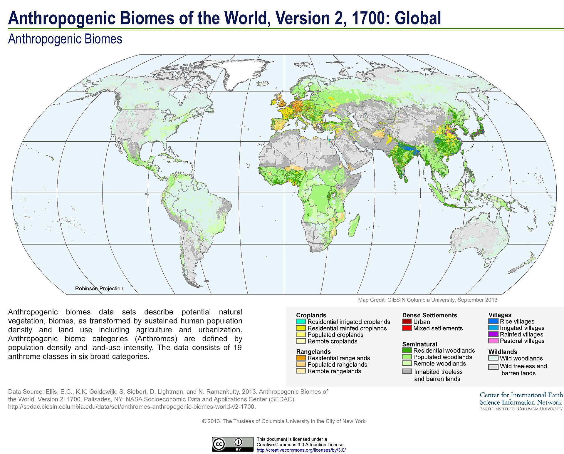
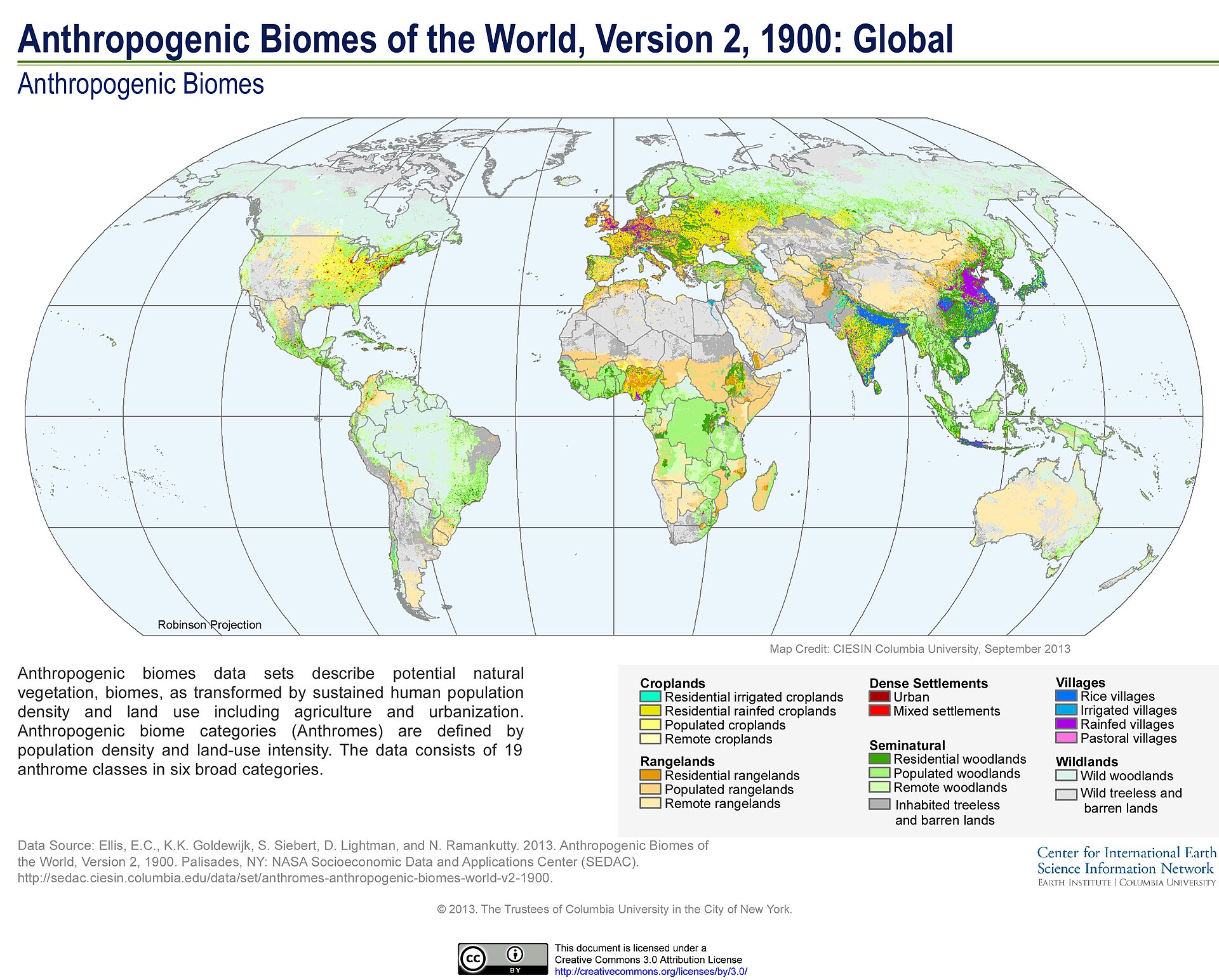
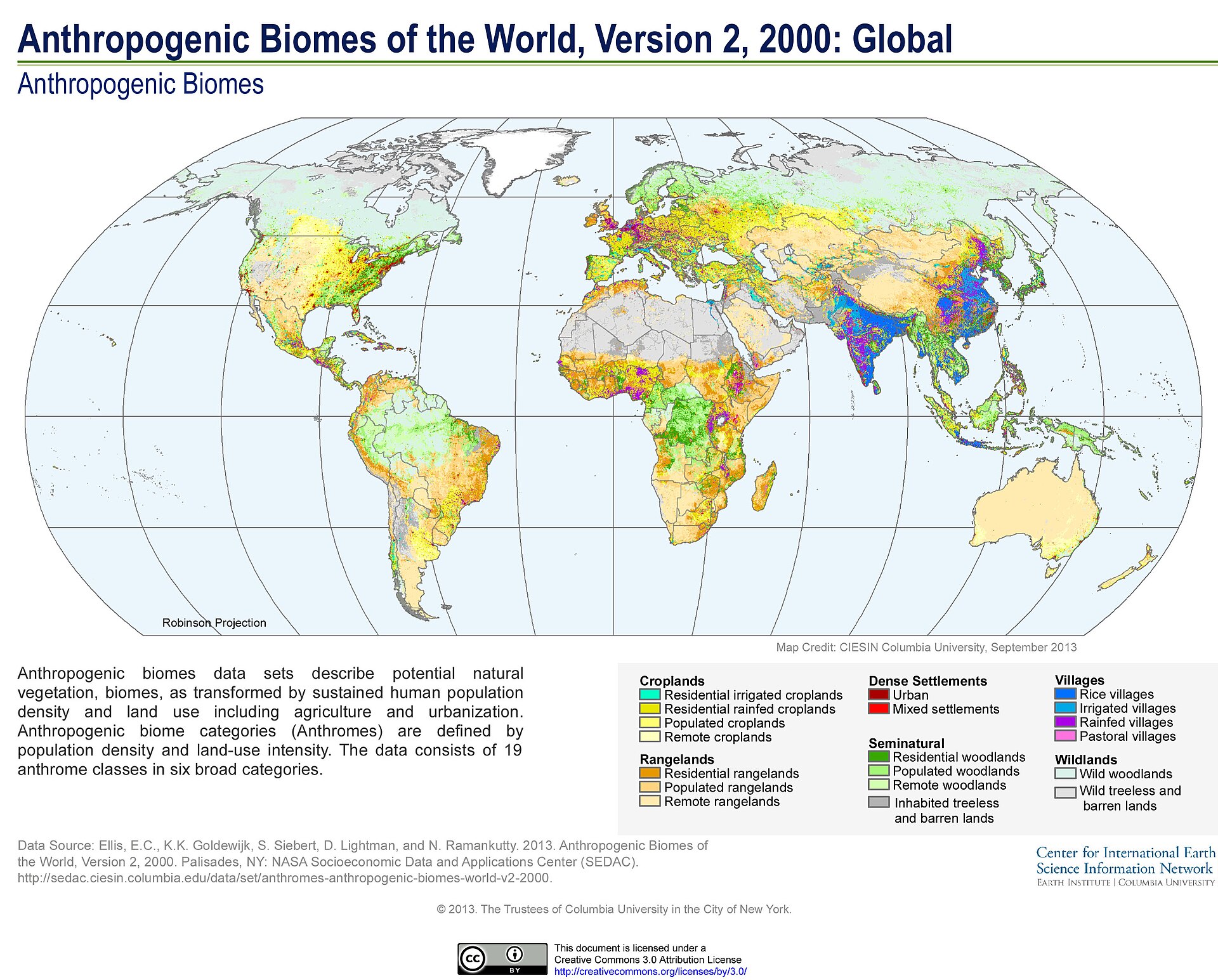
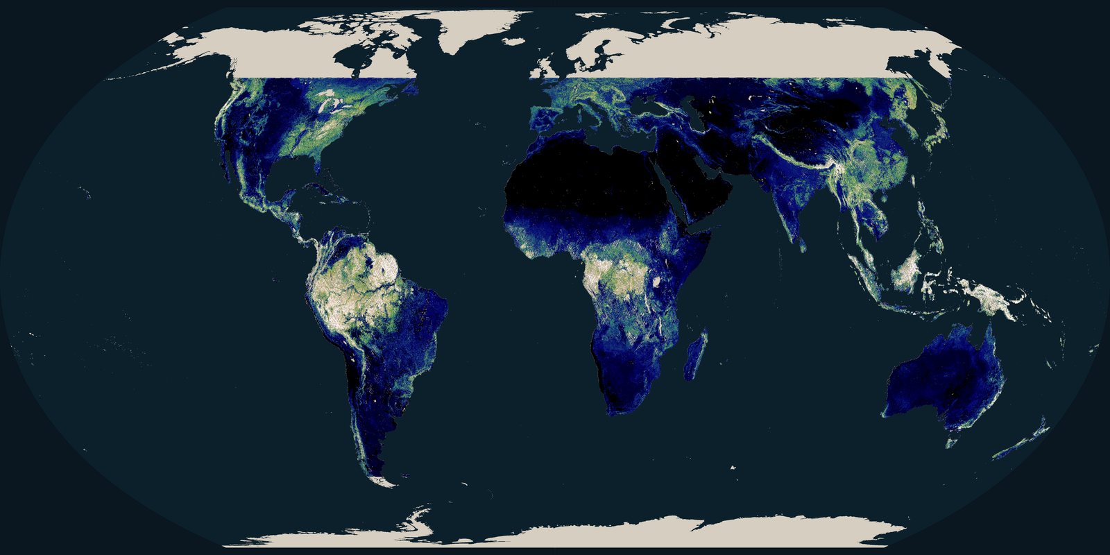
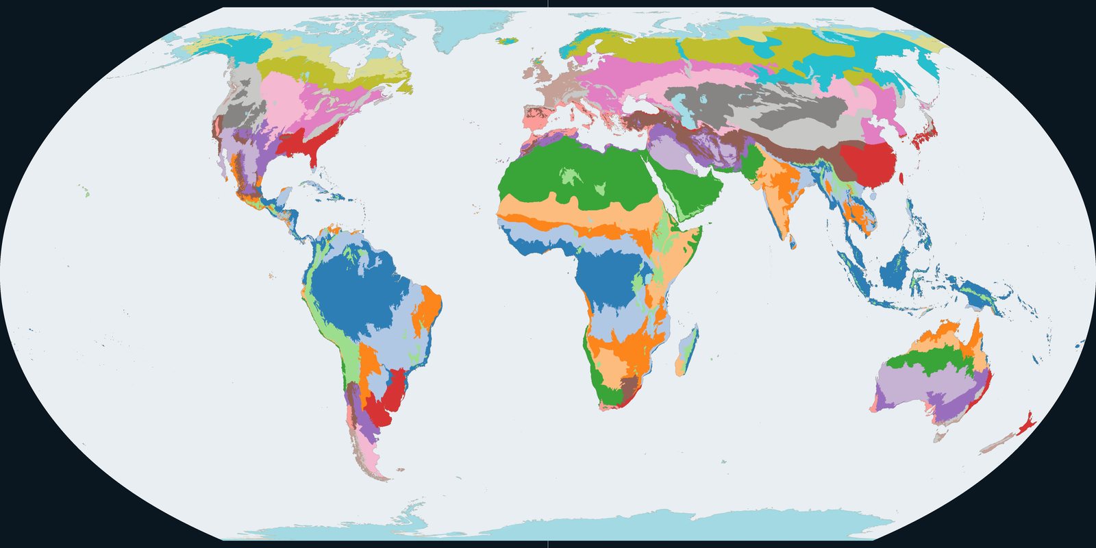
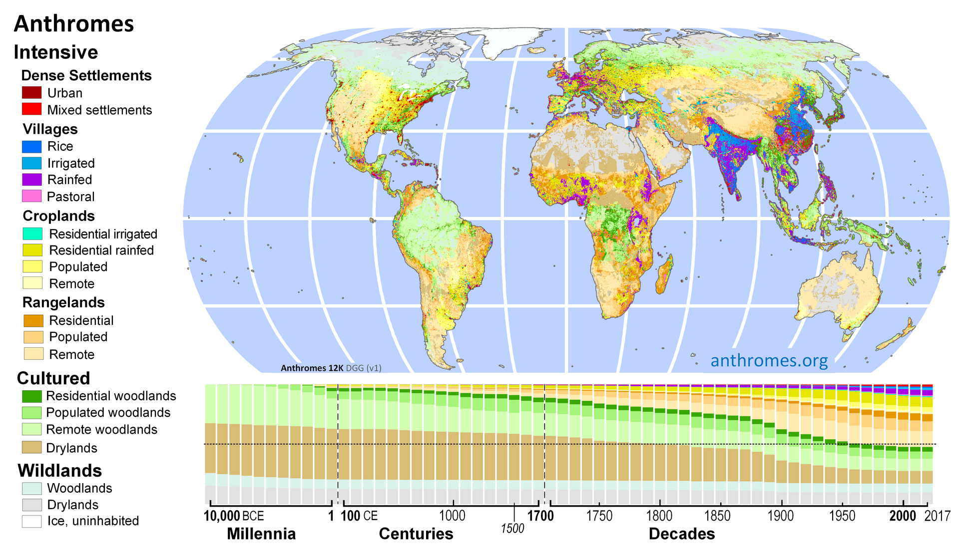
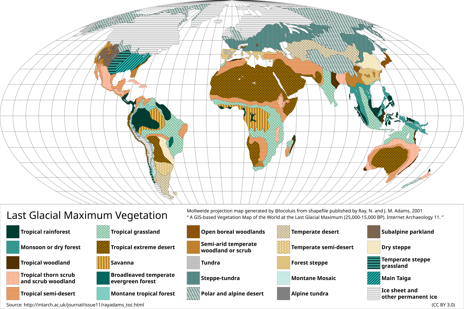
Five plates: vegetation at the last glacial maximum, a map of biomes under a recent climate, and Ellis anthromes: human-shaped biomes: for 1700, 1900, and 2000.

Mollweide reconstruction of Ice Age vegetation: ice sheets, tundra, reduced tropical forest, patterned legend
Ray & Adams 2001; map by Locoluis after their GIS shapefile. Vintage: ~25,000-15,000 BP.
Reconstruction / estimate ~18 ka Ray & Adams 2001

Last Glacial Maximum vegetation

Reconstruction, not satellite. Ray & Adams 2001 GIS vegetation, ~25,000-15,000 BP (~18,000 years ago). Ice sheets, more desert, less closed forest than now. This is older and colder than 10,000 BCE. Early Holocene forests were already expanding off this minimum.

https://intarch.ac.uk/journal/issue11/rayadams_toc.html
License: CC BY 3.0
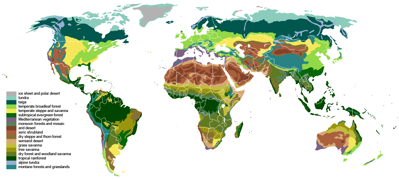
Color-coded world biome map: taiga, temperate forest, tropical rainforest, deserts and savannas
Ville Koistinen, Wikimedia biome plate (hand-compiled from atlas sources). Vintage: Recent-climate biome plate.
Reconstruction / estimate Biome plate Koistinen biomes

Potential biomes (recent climate)

Estimate / analogue: not a dated mid-Holocene pollen map. Ville Koistinen’s compiled biome plate (CC BY-SA). Useful for where forest can live under a recent climate. Mid-Holocene (~6,000 years ago) often had a greener Sahara and shifted forest limits; this drawing does not show that.

https://commons.wikimedia.org/wiki/File:Vegetation.png
License: CC BY-SA 3.0

Robinson map of 1700 anthropogenic biomes: pale wild woodlands, yellow croplands, blue villages
Ellis et al.; NASA SEDAC Anthropogenic Biomes v2, 1700. Vintage: 1700 reconstruction.
Reconstruction / estimate 1700 Ellis / SEDAC 1700

Anthromes, 1700

Reconstruction of human-shaped biomes, Ellis / SEDAC v2. Wild and remote woodlands still dominate much of the Americas, Africa, and boreal Eurasia. Cropland and villages already heavy in Europe, India, and eastern China. Not a tree-cover percent map.

https://sedac.ciesin.columbia.edu/data/set/anthromes-anthropogenic-biomes-world-v2-1700
License: CC BY 2.0