
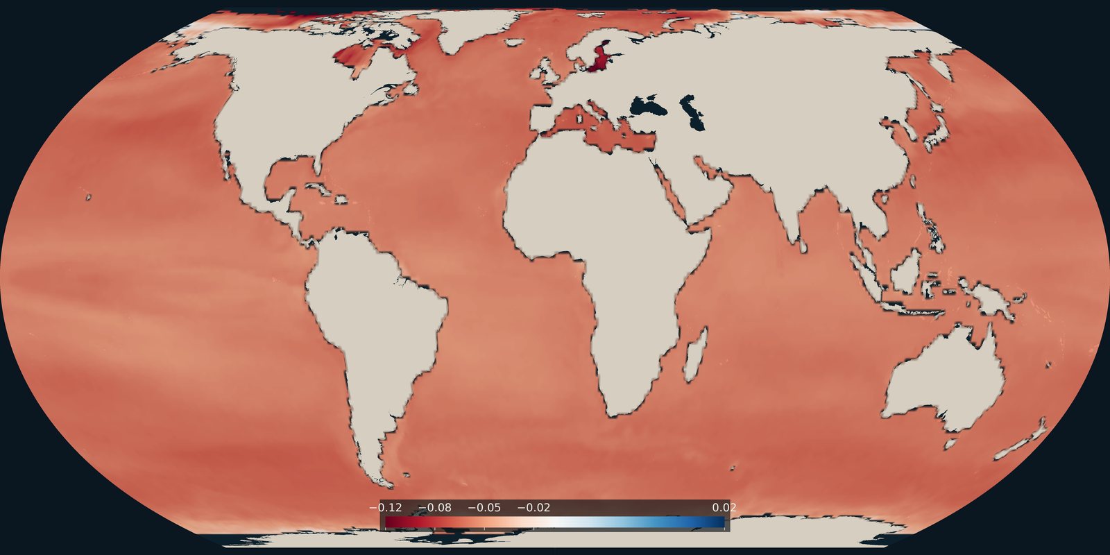
Ocean acidification
How much surface-ocean pH changed from the late 1980s to the early 2020s. A carbonate-chemistry trend, not temperature and not a pollution map.
Read the card →Salinity is the dissolved-salt content of seawater. Open-ocean surface values are typically about 32-37 grams of salt per kilogram of water: practical salinity, numerically close to the PSU scale.
Saltier water is denser. Together with temperature, salinity sets the density that drives thermohaline circulation: the slow overturning that links surface currents to the deep ocean. Rivers, rain, and melting ice freshen the surface; evaporation and sea-ice formation make it saltier.
The figures are NASA Aquarius observations of sea-surface salinity from the 2011-2015 mission.
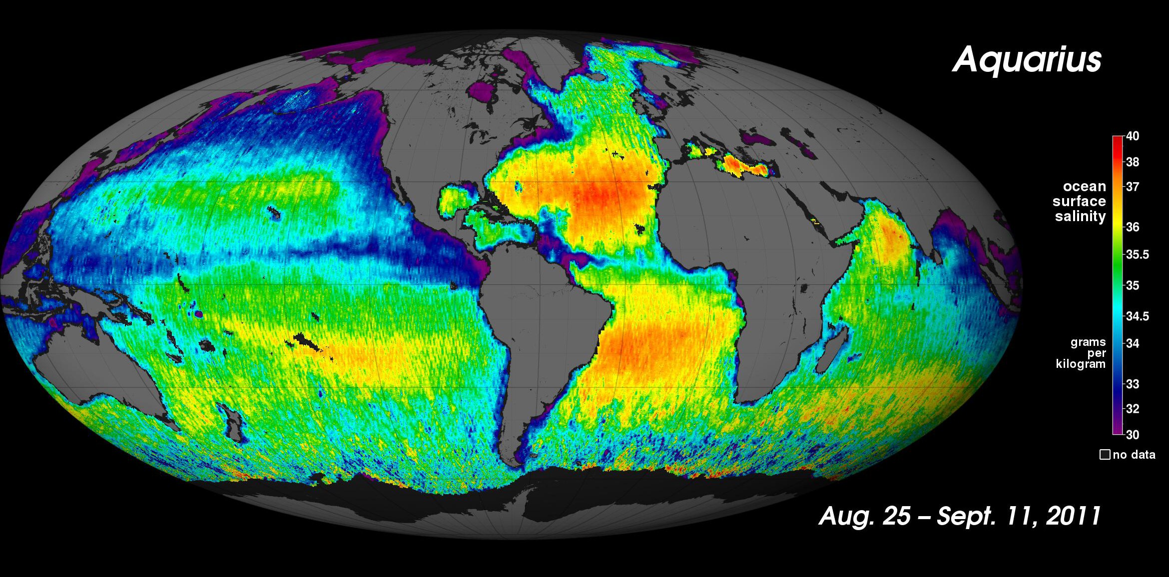
NASA Aquarius, 2011-2015. Observed surface salinity in g/kg. Later satellite months: SMAP, in NASA Worldview.
NASA Aquarius, 25 August-11 September 2011: the mission’s first global sea-surface salinity map. Microwave SSS, in g/kg. Fresher plumes at the Amazon and Ganges; saltier subtropical Atlantic.
On the 2011 global map, purple and blue mark fresher water (Amazon and Ganges plumes, high latitudes); yellow and red mark saltier subtropical seas, especially the North Atlantic and the Arabian Sea. Units are g/kg. The second figure is a 3-D Atlantic view from the same mission.
The SMAP mission continues microwave sea-surface salinity after Aquarius. World Ocean Atlas 2023 is a separate in-situ climatology: bottles, CTDs, and floats, averaged over many years.
NASA / JPL-Caltech, Aquarius mission first global salinity map
Vintage: 25 Aug-11 Sep 2011
https://www.jpl.nasa.gov/images/pia14786-aquarius-unveils-the-salty-sea/
License:
Public domain (NASA)
Open NASA Worldview SMAP salinity → World Ocean Atlas 2023 →
How much surface-ocean pH changed from the late 1980s to the early 2020s. A carbonate-chemistry trend, not temperature and not a pollution map.
Read the card →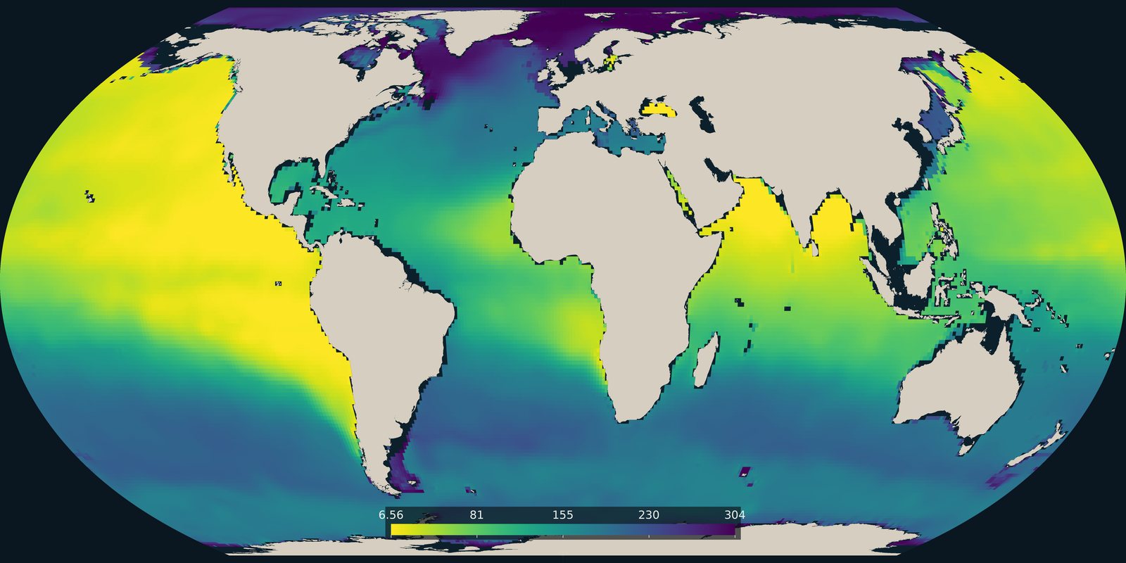
The lowest dissolved oxygen between 100 and 1000 metres in the World Ocean Atlas 2023 climatology. Open-ocean oxygen, not the coastal dead-zone pins on Pollution.
Read the card →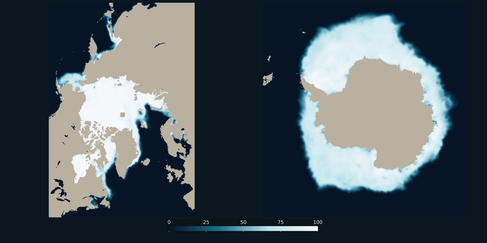
Sea-ice concentration for a recent Arctic March and Antarctic September, side by side. Frozen ocean cover, not surface temperature and not land ice.
Read the card →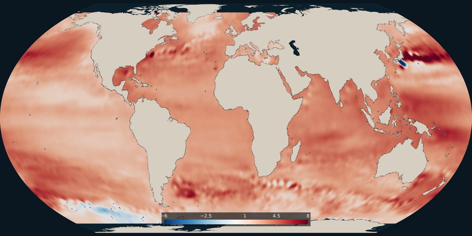
Where the ocean surface is rising faster or more slowly, in millimetres per year. The global average cited on this site comes from the NASA Sea Level Change Portal.
Read the card →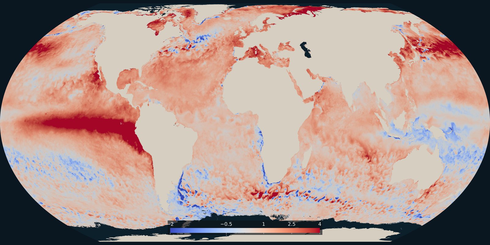
Where the sea surface was warmer or cooler than usual on 25 September 2026. A temperature anomaly from NOAA Coral Reef Watch, not a classified heatwave category.
Read the card →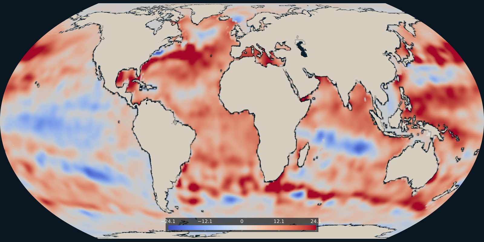
Heat stored in the upper 700 metres in 2025, as an anomaly in each 1° cell, from NOAA NCEI.
Read the card →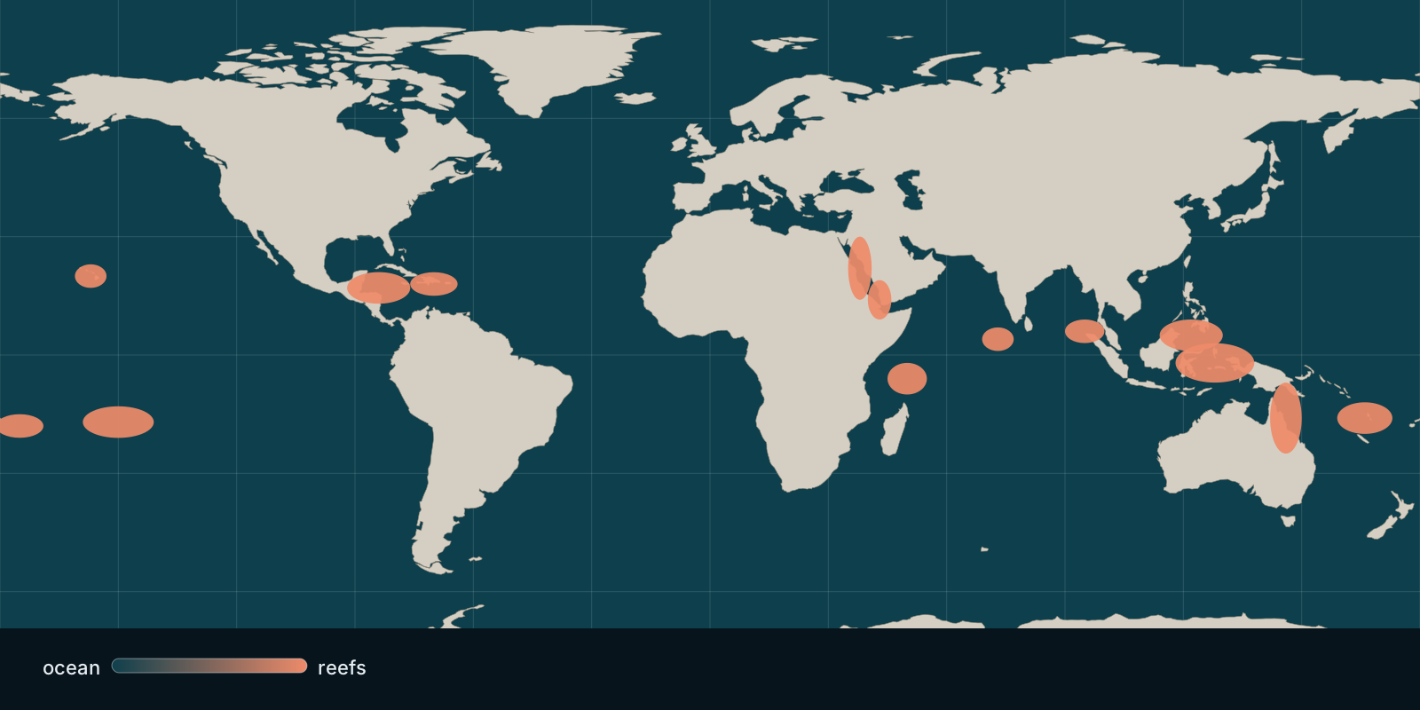 Fix Planet overview
Where hard coral cover stands today and how heat stress bleaches reefs, based on global monitoring and satellite observations.
Read the card →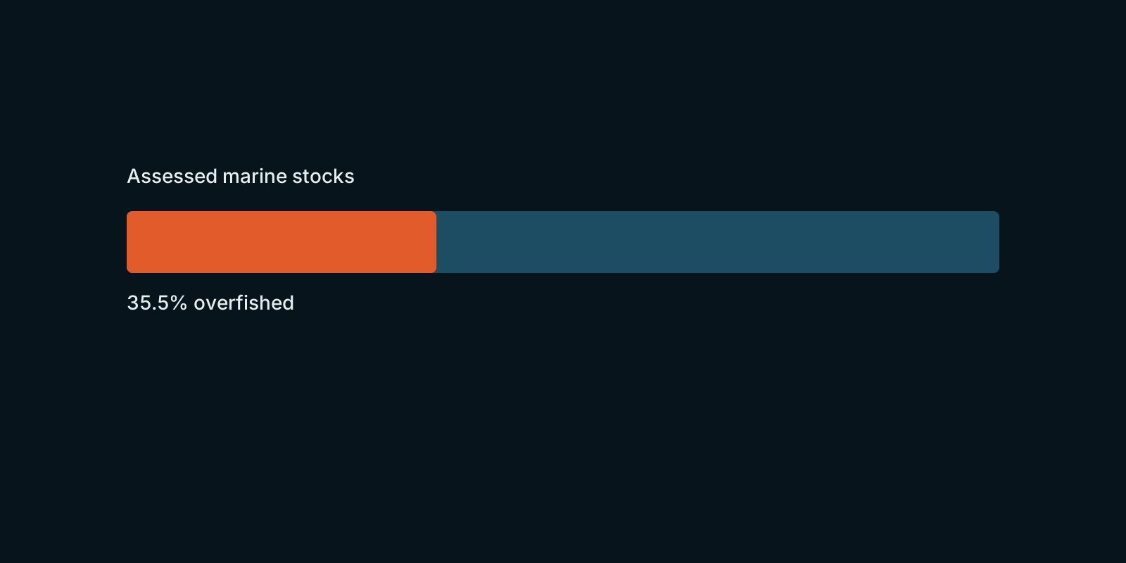 Fix Planet overview
How assessed marine fish stocks are doing worldwide, according to FAO’s global stock-status figures.
Read the card →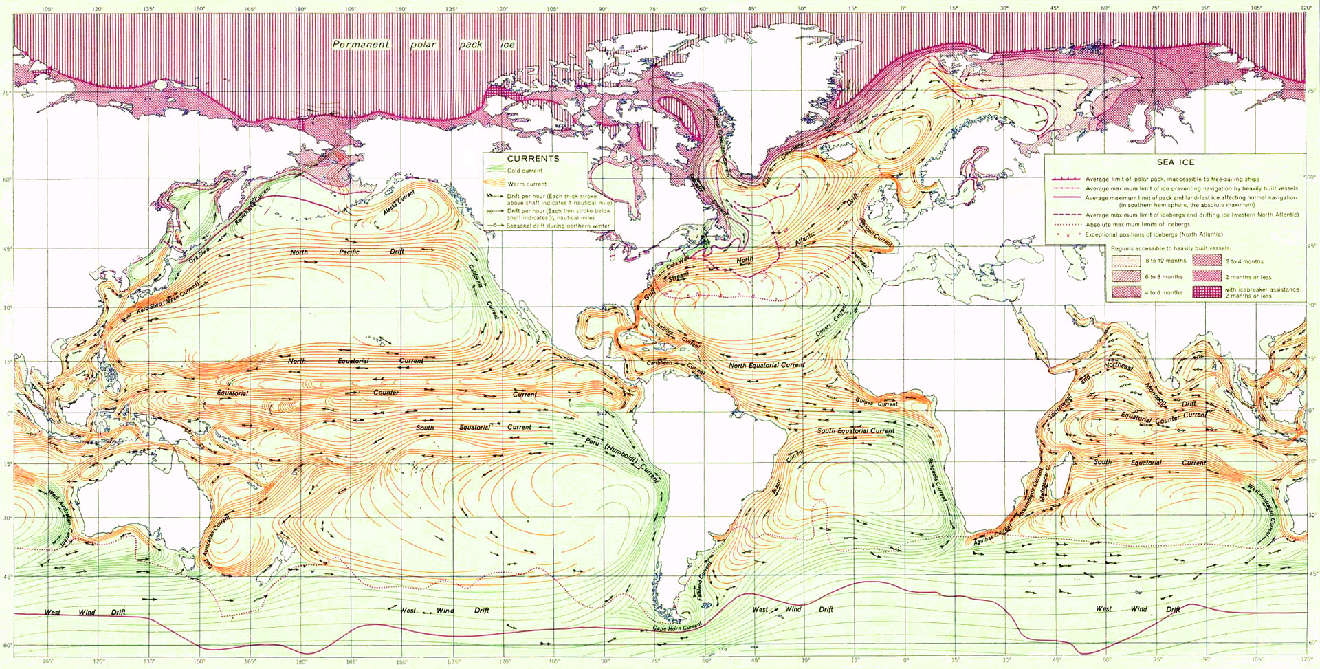
Surface currents and the great gyres that steer heat, salt, and life.
Read the card →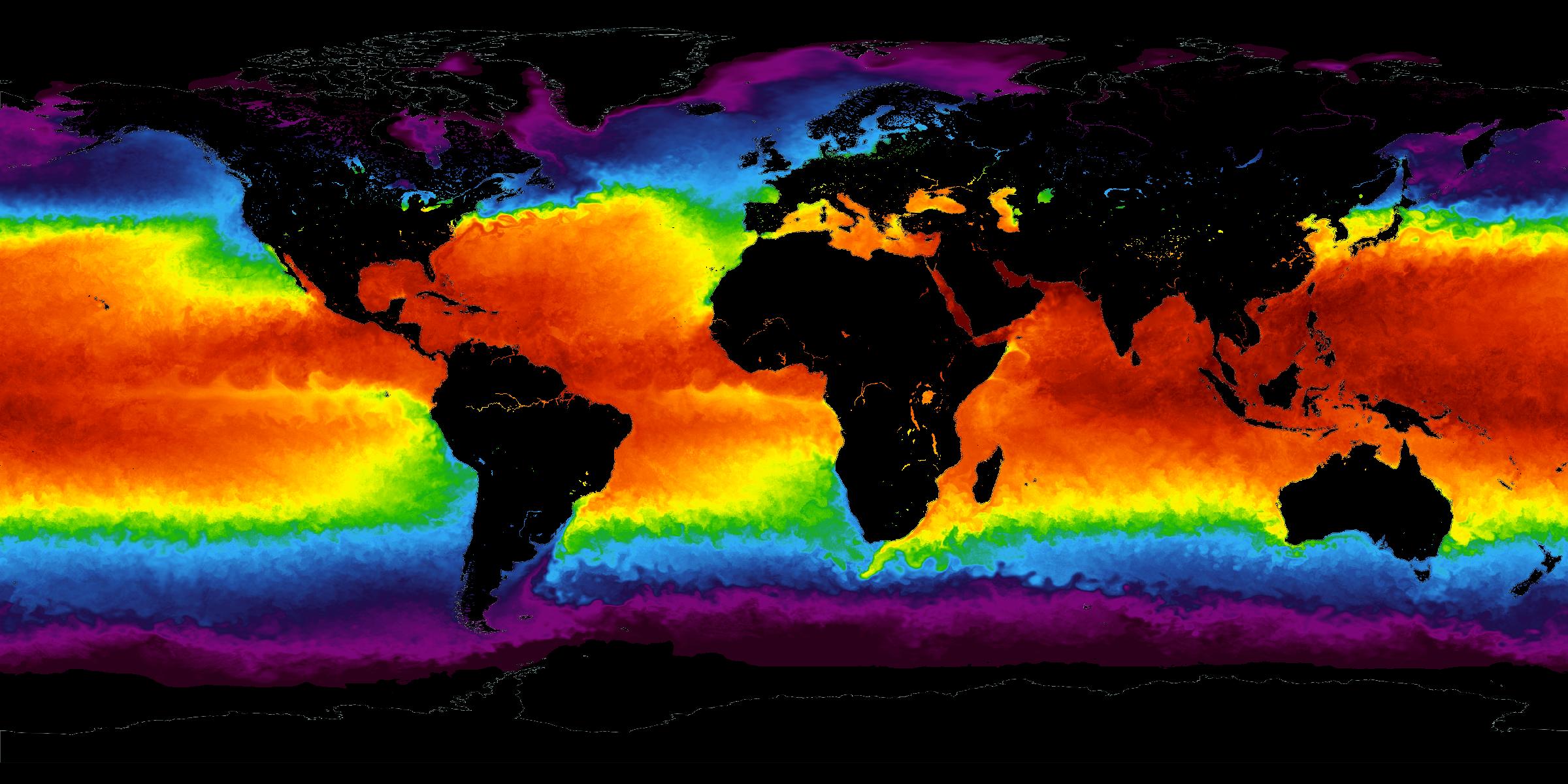
The temperature of the sea surface: the standing climate, and years that run warmer or cooler.
Read the card →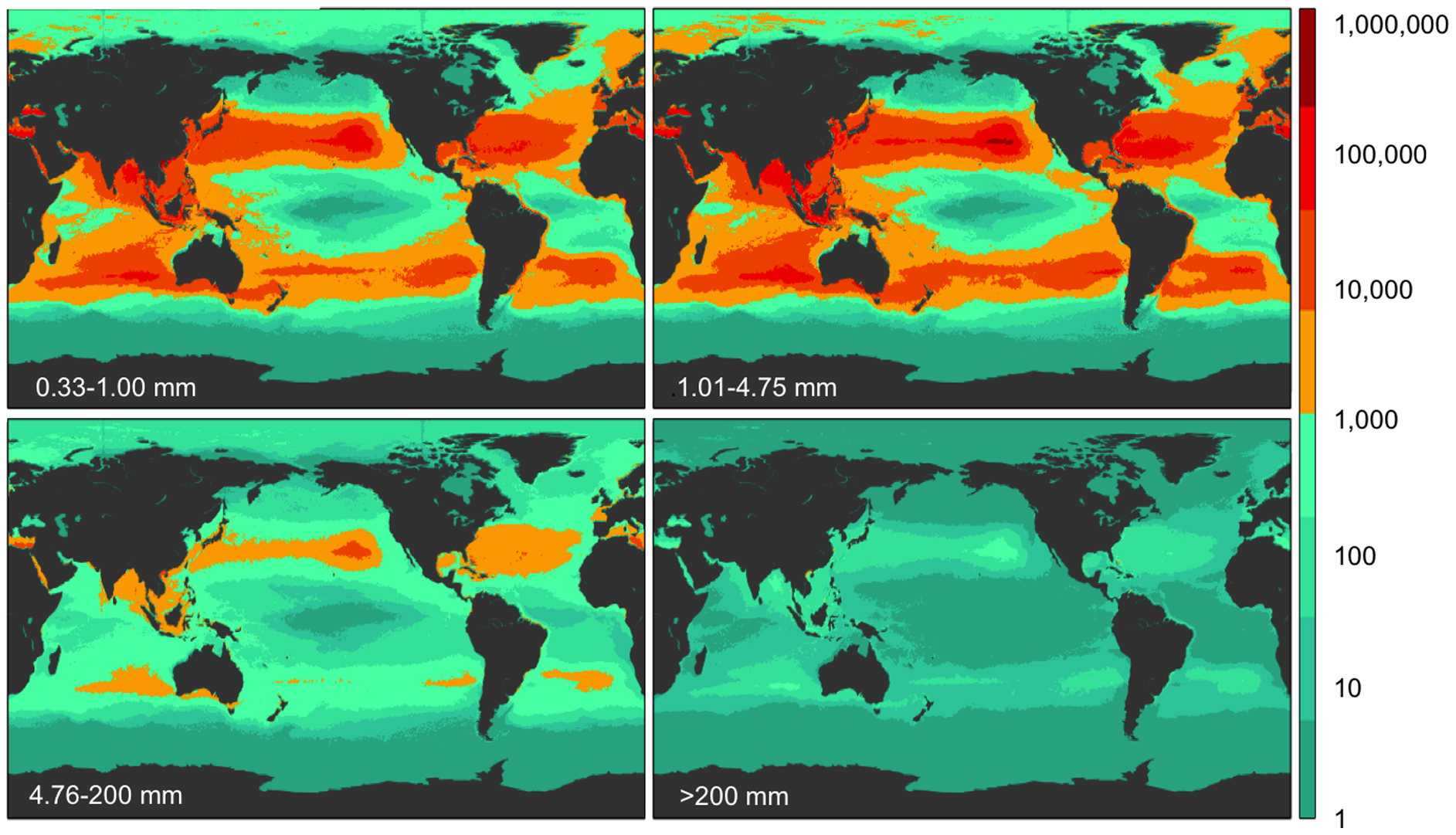
Five subtropical garbage patches, oil, phytoplankton blooms, and coastal dead zones.
Read the card →Heat, acidity, plastic, and hypoxia, each from a named paper.
Read the card →