

Ethnolinguistic
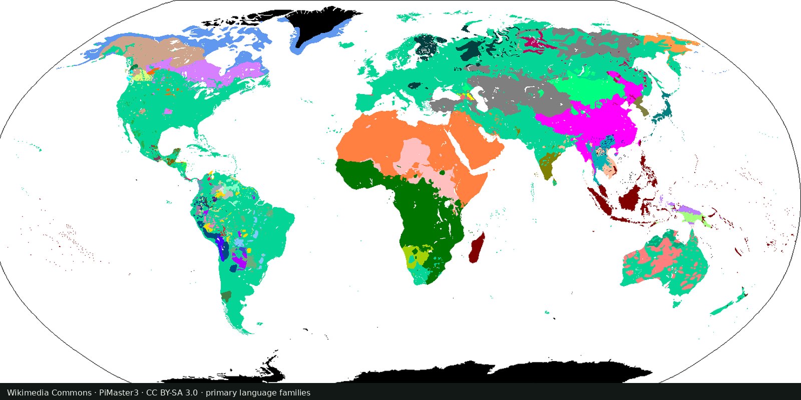
Language families of the world
A linguistic map of related languages, an approximation of ethnolinguistic geography, not a census of peoples.
Read the card →Structural features of languages: sound systems, word order, grammar, mapped from reference grammars. Typology, not ethnicity and not a family tree.
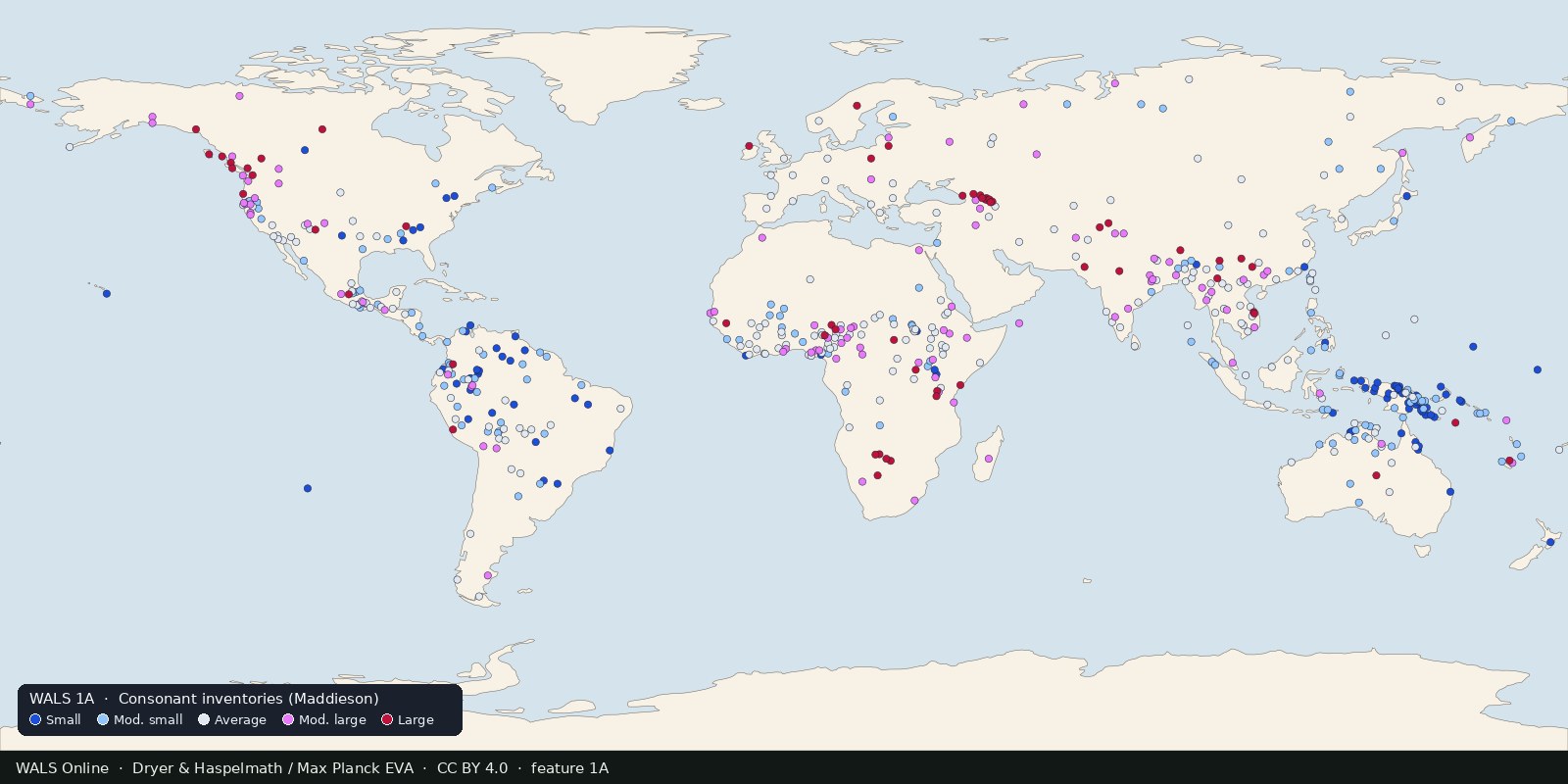
WALS Online (World Atlas of Language Structures) is a Max Planck Institute for Evolutionary Anthropology publication: a large database of phonological, grammatical, and lexical properties coded from descriptive grammars by a team of authors. First book+CD 2005 (OUP); online from 2008; 2013 edition with ongoing corrections. The live Glottolog card on this shelf already points readers to WALS as the related scholarly atlas of structure.
Glottolog answers “who is related to whom.” WALS answers “which structural features show up where.” Both are language science, not political ethnicity. Putting WALS on the Ethnic shelf keeps the promise that ethnolinguistic maps here are about speech systems.
Each feature chapter is a separate map (e.g. consonant inventory size, dominant word order). A color is a coding value for that feature in a sampled language, usually at a reference point: not a claim that everyone in the polygon speaks one tongue or shares one identity. Cite the specific WALS chapter you use; cite the general work only when drawing on many chapters. Dataset versioning is published via the WALS project (see GitHub CLDF release); the interactive atlas is https://wals.info/.
A color is a coding value in a sampled language, not a people and not a state. Languages are not peoples and not states.
WALS Online data are CC BY 4.0 (Dryer & Haspelmath / Max Planck Institute for Evolutionary Anthropology). The preview redraws feature 1A, Consonant Inventories (Maddieson), from the CLDF release: a structural typology map, not Glottolog families and not UNESCO endangerment pins.
Open source map → A linguistic map of related languages, an approximation of ethnolinguistic geography, not a census of peoples.
Read the card →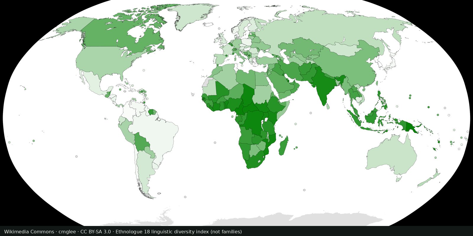
Ethnologue’s public insight on how many living languages are counted, a magnitude card next to the Glottolog family map, not a second family atlas.
Read the card →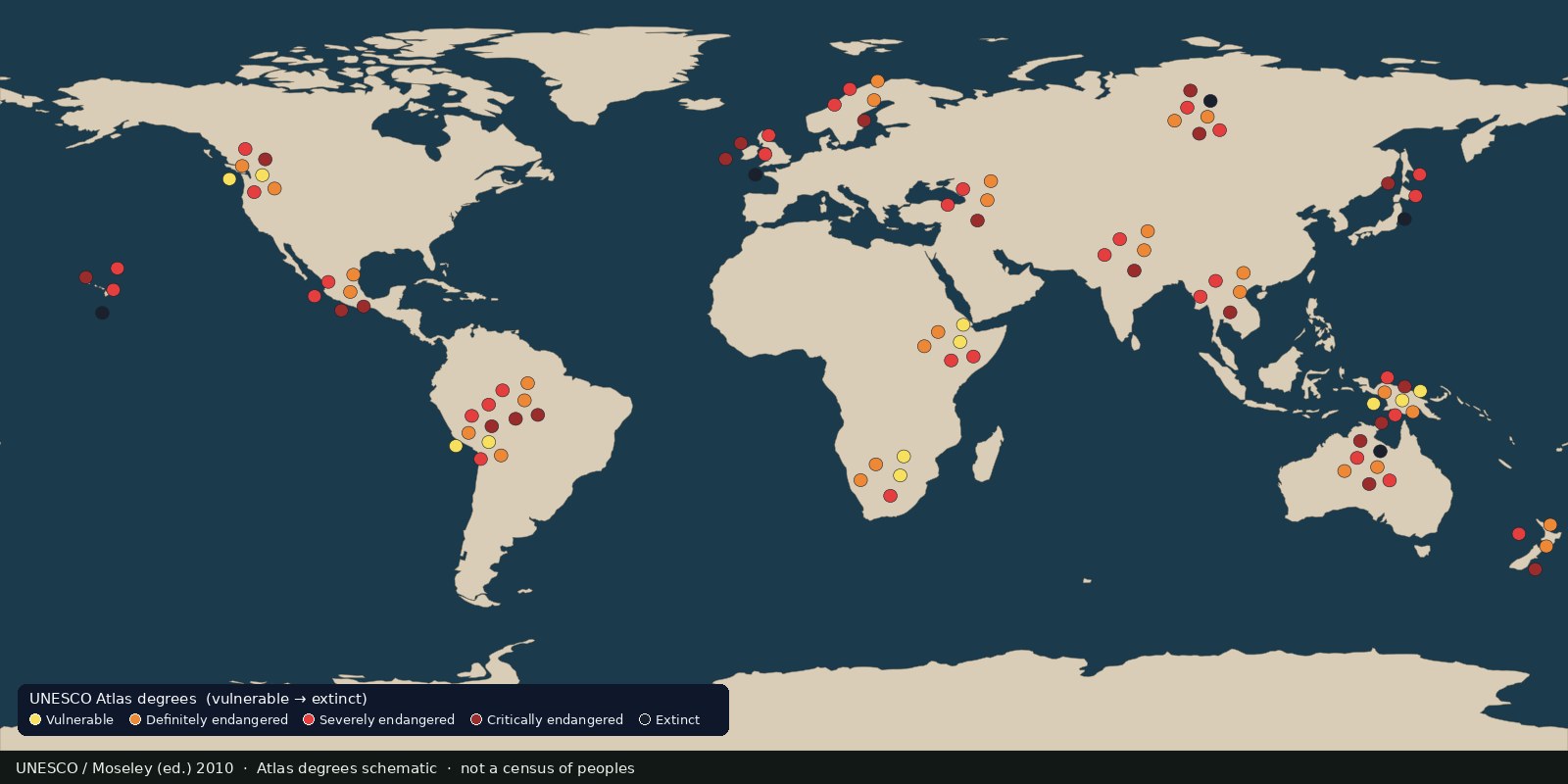 Fix Planet overview
Languages UNESCO listed as vulnerable to extinct, an endangerment atlas, not a census of peoples and not a second family-tree map.
Read the card →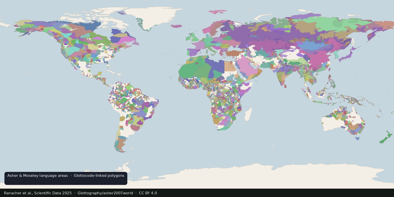
Open polygons for language areas digitized from Asher & Moseley’s atlas and linked to Glottocodes, areas, not single Glottolog points, and still not a census of peoples.
Read the card →Source: Ranacher et al., Scientific Data 2025: language areas from Asher & Moseley
 Fix Planet overview
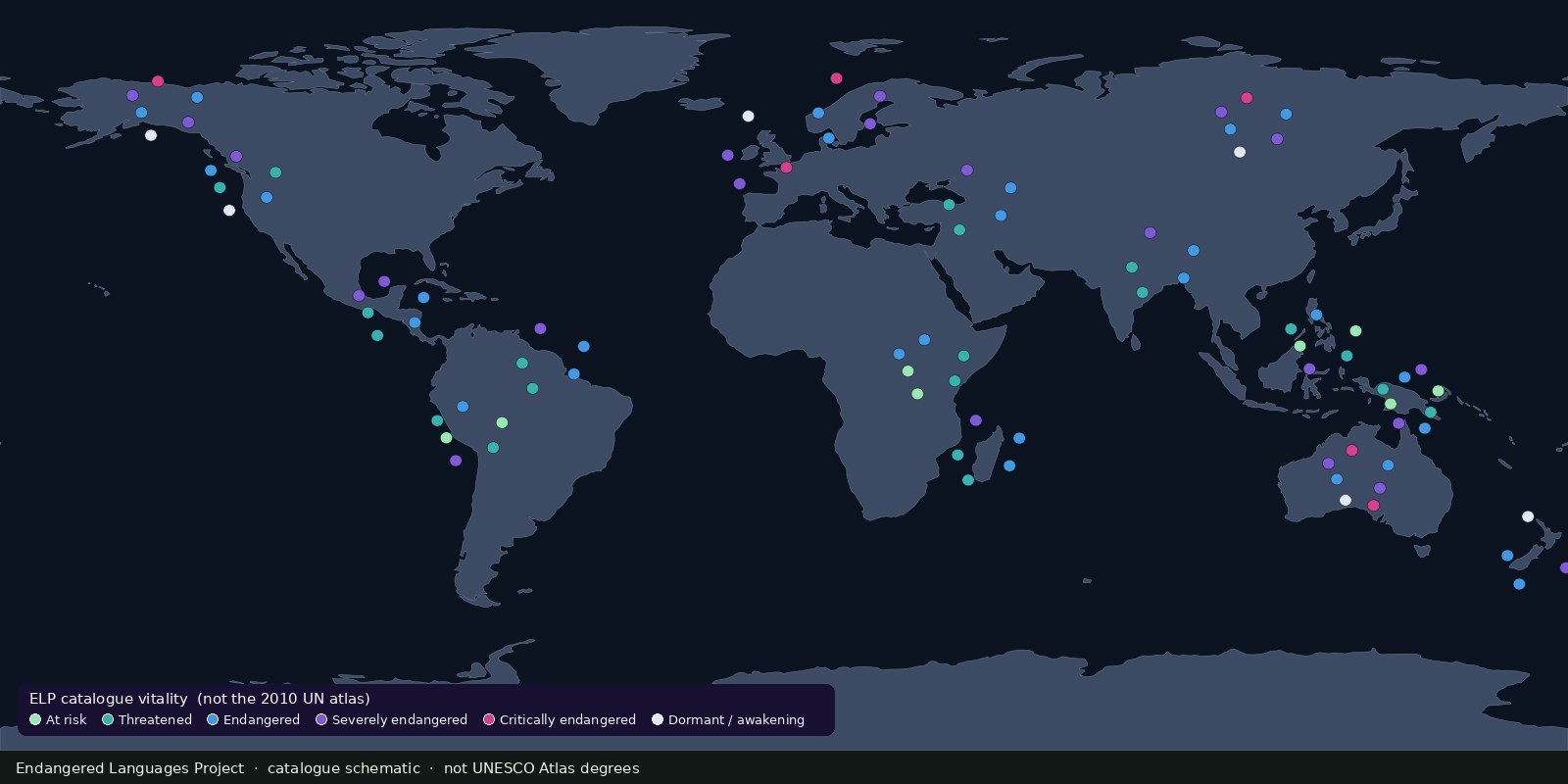
A living catalogue and map of endangered and Indigenous languages with community resources, another endangerment lens beside UNESCO’s 2010 Atlas, not a second Glottolog.
Read the card →