

Ethnolinguistic
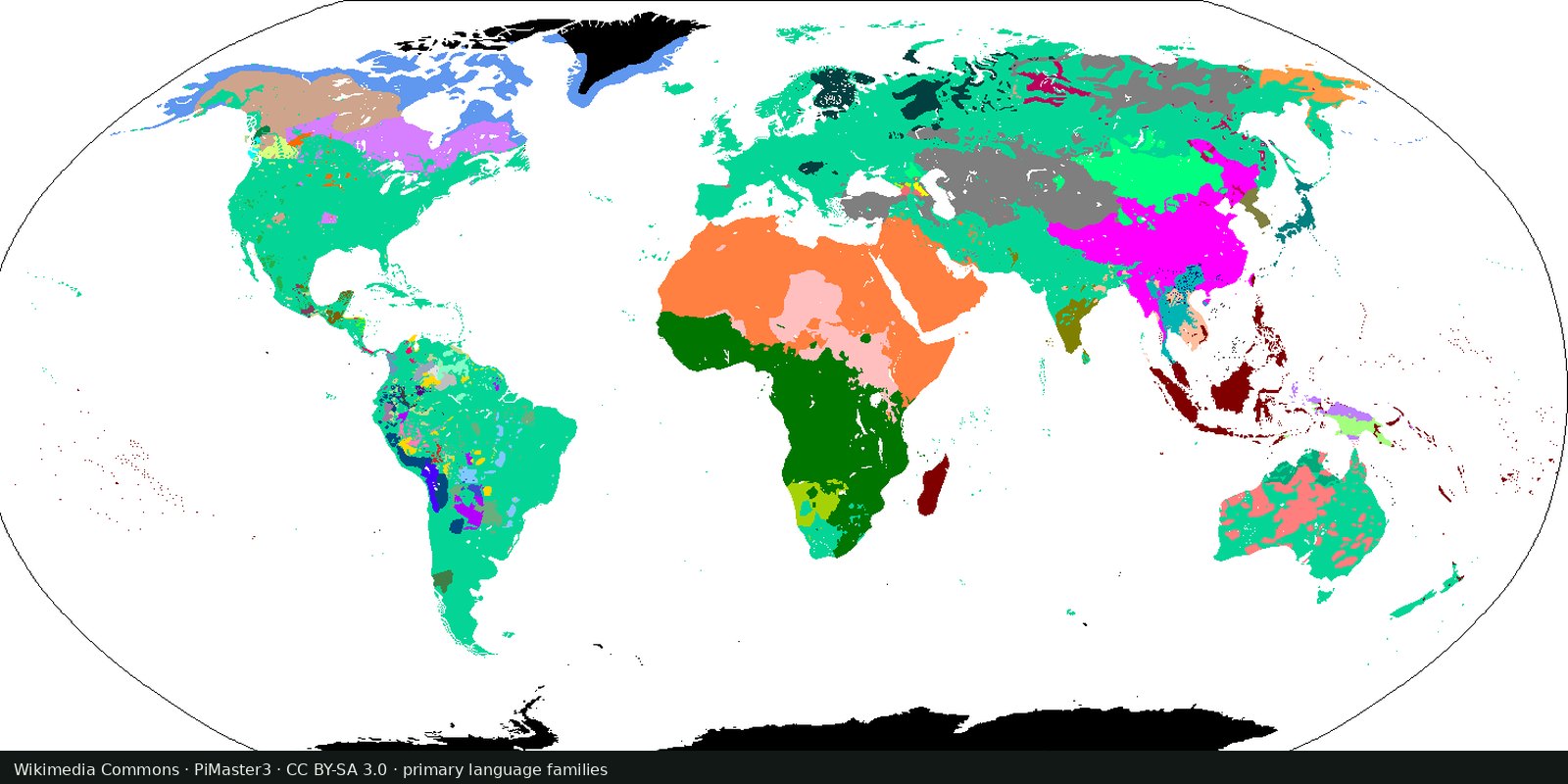
Language families of the world
A linguistic map of related languages, an approximation of ethnolinguistic geography, not a census of peoples.
Read the card →Languages UNESCO listed as vulnerable to extinct, an endangerment atlas, not a census of peoples and not a second family-tree map.
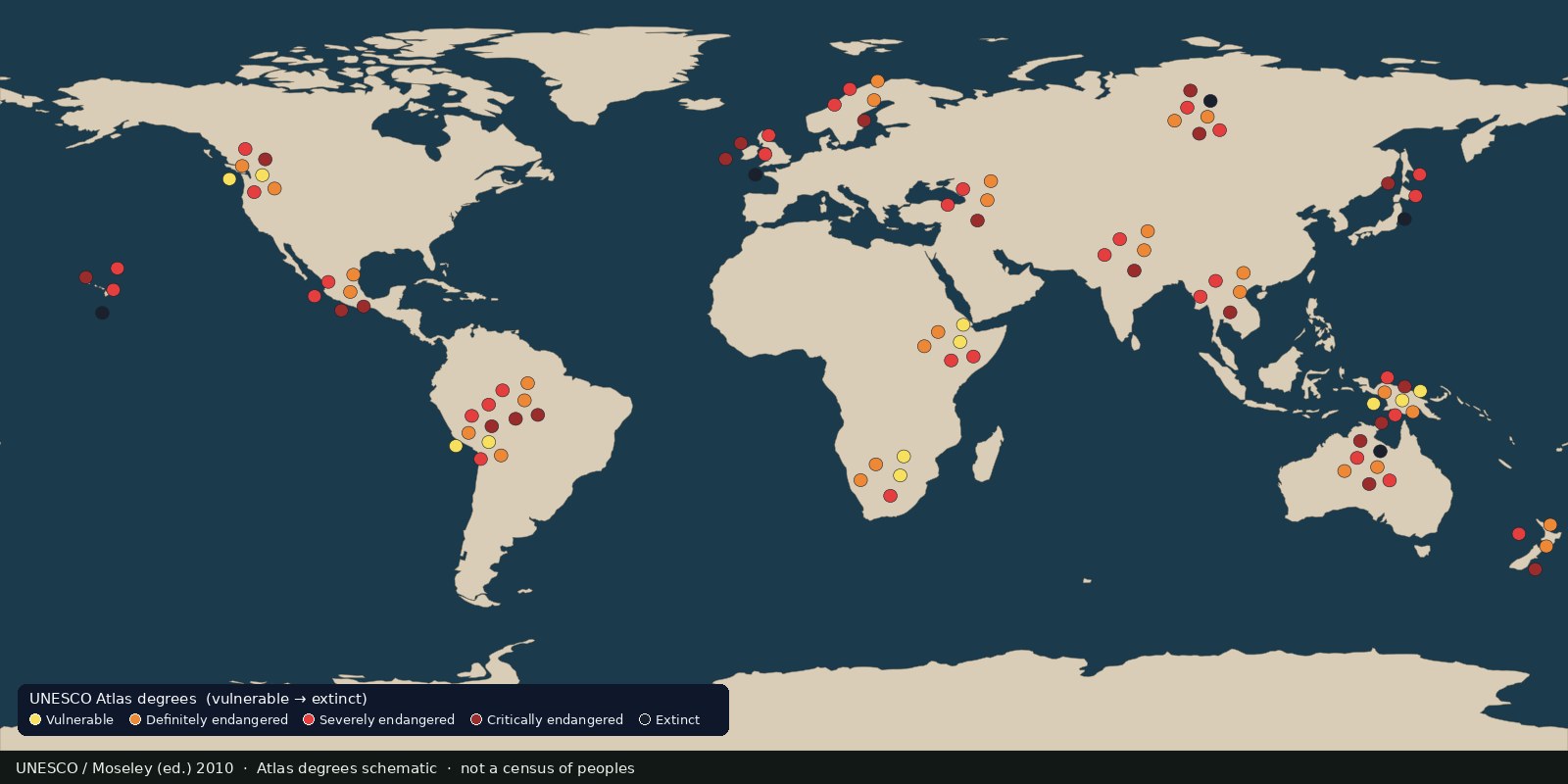
UNESCO’s Atlas of the World’s Languages in Danger (3rd edn, Moseley ed., 2010; UNESDOC) lists about 2,500 languages with a degree of endangerment based on intergenerational transmission and related vitality factors. The print Atlas and its (archived) interactive companion were built to monitor linguistic diversity loss, scholarly and policy cartography, not a headcount of ethnic groups.
The live Glottolog card shows relatedness; Ethnologue’s living-languages insight shows inventory size. This card answers a different question: which languages the UN cultural agency treated as endangered, and at what degree. It belongs next to family and count cards, not under Conflicts or Political.
Degrees (vulnerable, definitely/severely/critically endangered, extinct) are expert judgements from the Atlas framework, not court findings and not DNA. A pin or shade means “this language was coded endangered in that edition,” not “this land belongs to one people.” Prefer the UNESDOC edition as the citable source of record; do not invent a live interactive UNESCO URL that no longer resolves.
Many speakers are multilingual; colonial borders cut across speech communities. Languages are not peoples and not states. A pin is not a claim about blood, loyalty, or territory.
UNESCO / Moseley (ed.) 2010. The preview is a Fix Planet schematic of Atlas endangerment degrees (vulnerable → extinct) on a public-domain world outline, not a political ethnicity choropleth and not a second Glottolog family tree. Cite the UNESDOC edition.
Open source map → A linguistic map of related languages, an approximation of ethnolinguistic geography, not a census of peoples.
Read the card →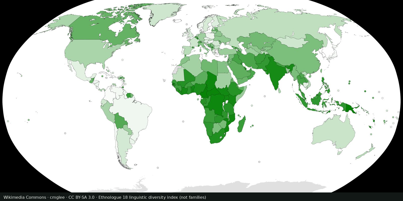
Ethnologue’s public insight on how many living languages are counted, a magnitude card next to the Glottolog family map, not a second family atlas.
Read the card →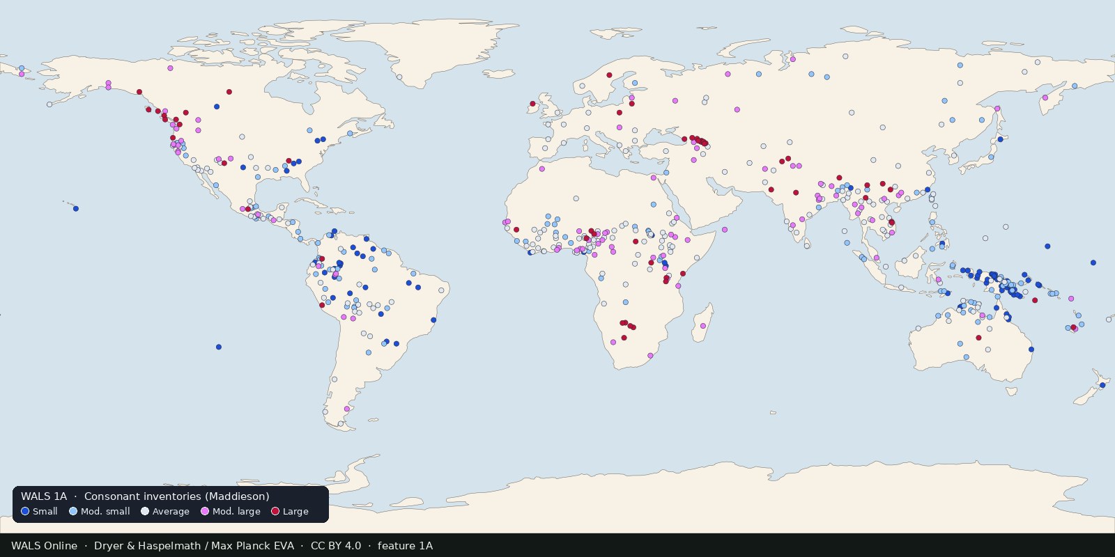
Structural features of languages: sound systems, word order, grammar, mapped from reference grammars. Typology, not ethnicity and not a family tree.
Read the card →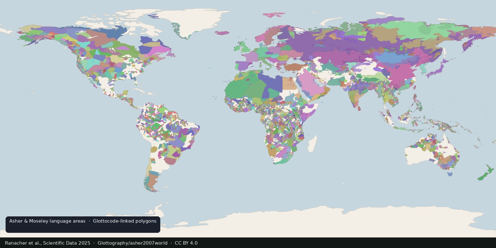
Open polygons for language areas digitized from Asher & Moseley’s atlas and linked to Glottocodes, areas, not single Glottolog points, and still not a census of peoples.
Read the card →Source: Ranacher et al., Scientific Data 2025: language areas from Asher & Moseley
 Fix Planet overview
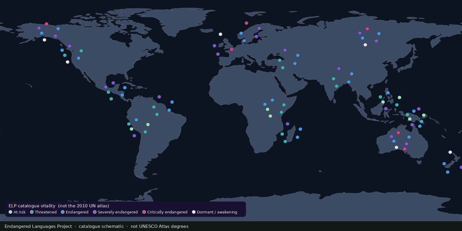
A living catalogue and map of endangered and Indigenous languages with community resources, another endangerment lens beside UNESCO’s 2010 Atlas, not a second Glottolog.
Read the card →