

Ethnolinguistic
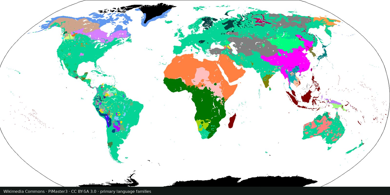
Language families of the world
A linguistic map of related languages, an approximation of ethnolinguistic geography, not a census of peoples.
Read the card →Open polygons for language areas digitized from Asher & Moseley’s atlas and linked to Glottocodes, areas, not single Glottolog points, and still not a census of peoples.
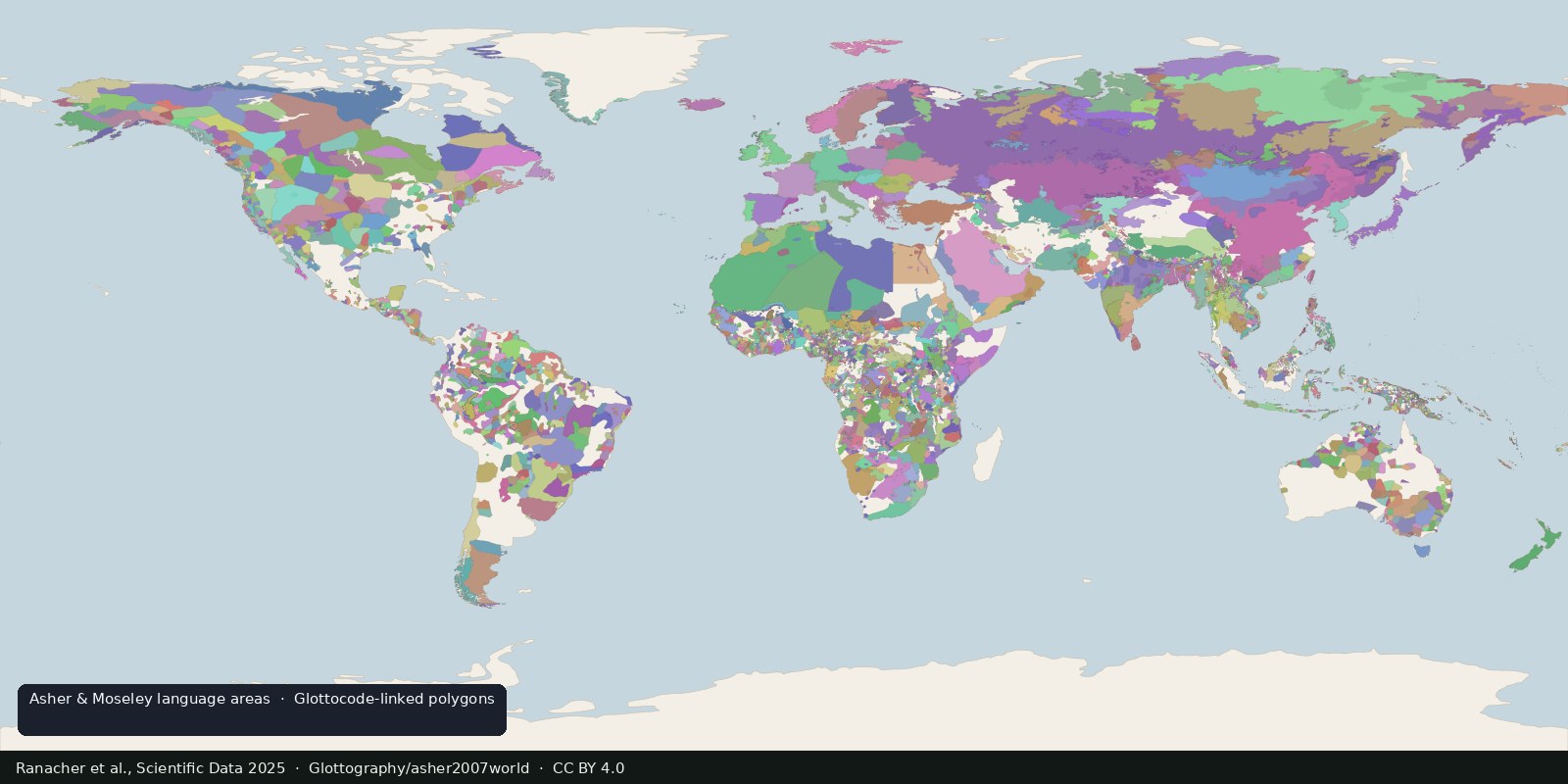
Asher & Moseley’s Atlas of the World’s Languages drew language distributions as printed maps. A 2025 Scientific Data paper (Ranacher et al.) georeferenced those sheets, digitized 6,992 distinct language-area polygons, and linked each polygon to a Glottocode. Data are released as a faithful replication plus enriched aggregates (GitHub Glottography / asher2007world). This closes a gap Glottolog itself states: Glottolog gives coordinates (points), not speaker-area polygons.
Live Language families is Glottolog classification geography. This card is the complementary object: polygonal language areas from a named atlas, interoperable with Glottolog IDs. It is still linguistic geography: not Political admin-0 and not Ethnicity-as-race.
Treat polygons as “the atlas drew a speech-area here,” generalized for atlas scale. Historical vs contemporary sheets differ; colonial borders and multilingual regions cut across neat fills. Do not merge into World countries. Do not treat a Glottocode link as proof of sovereignty or blood. Prefer citing the Scientific Data article + the GitHub dataset together.
Polygons are a generalized atlas drawing of a speech-area, not sovereignty and not blood. Languages are not peoples and not states.
Language-area polygons from Glottography/asher2007world (CC BY 4.0), digitized from Asher & Moseley and linked to Glottocodes; cite Ranacher et al., Scientific Data 2025. The preview samples those areas from the traditional / time-of-contact sheets, not the Glottolog family choropleth and not a census of peoples.
Open source map → A linguistic map of related languages, an approximation of ethnolinguistic geography, not a census of peoples.
Read the card →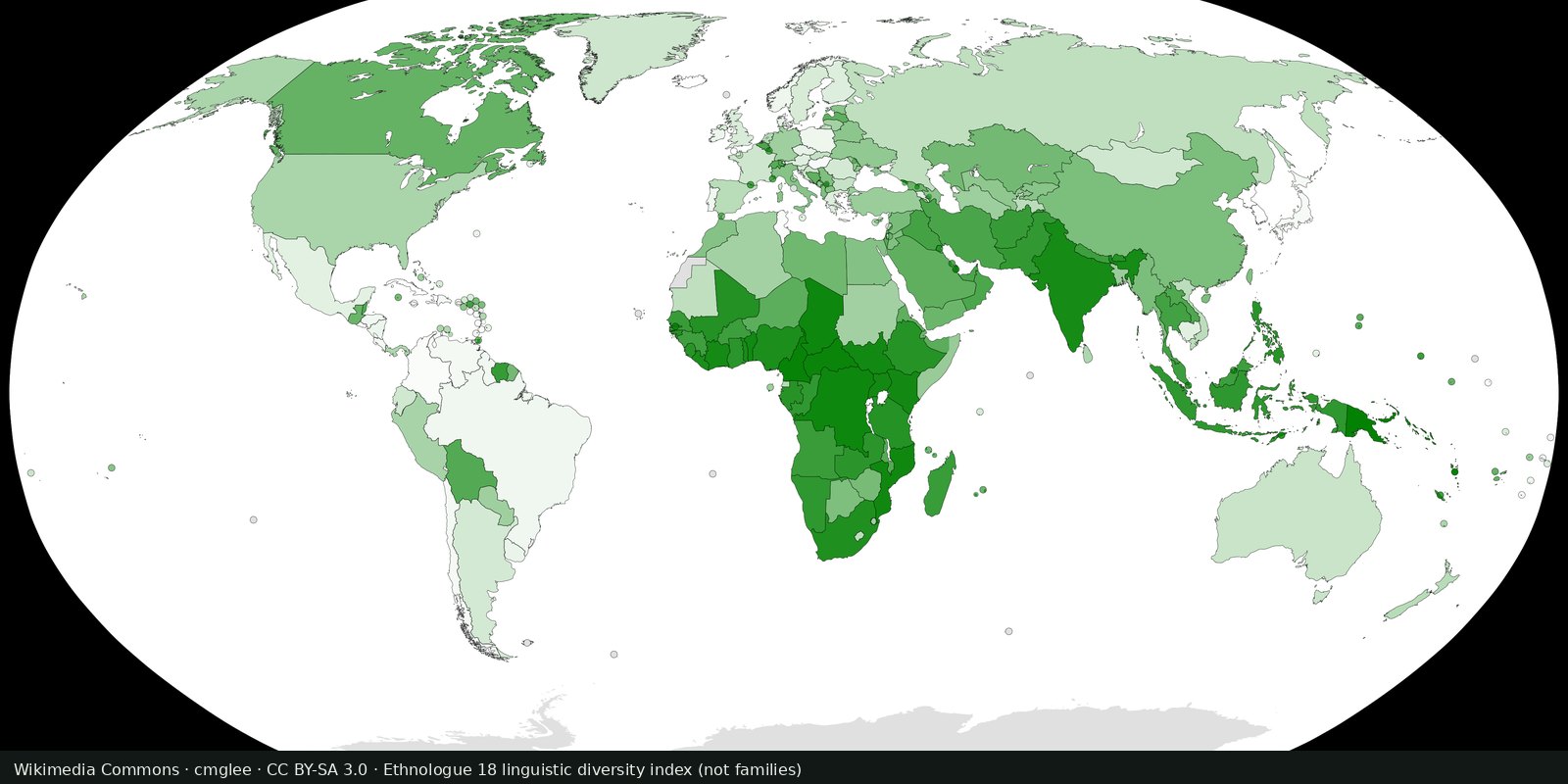
Ethnologue’s public insight on how many living languages are counted, a magnitude card next to the Glottolog family map, not a second family atlas.
Read the card →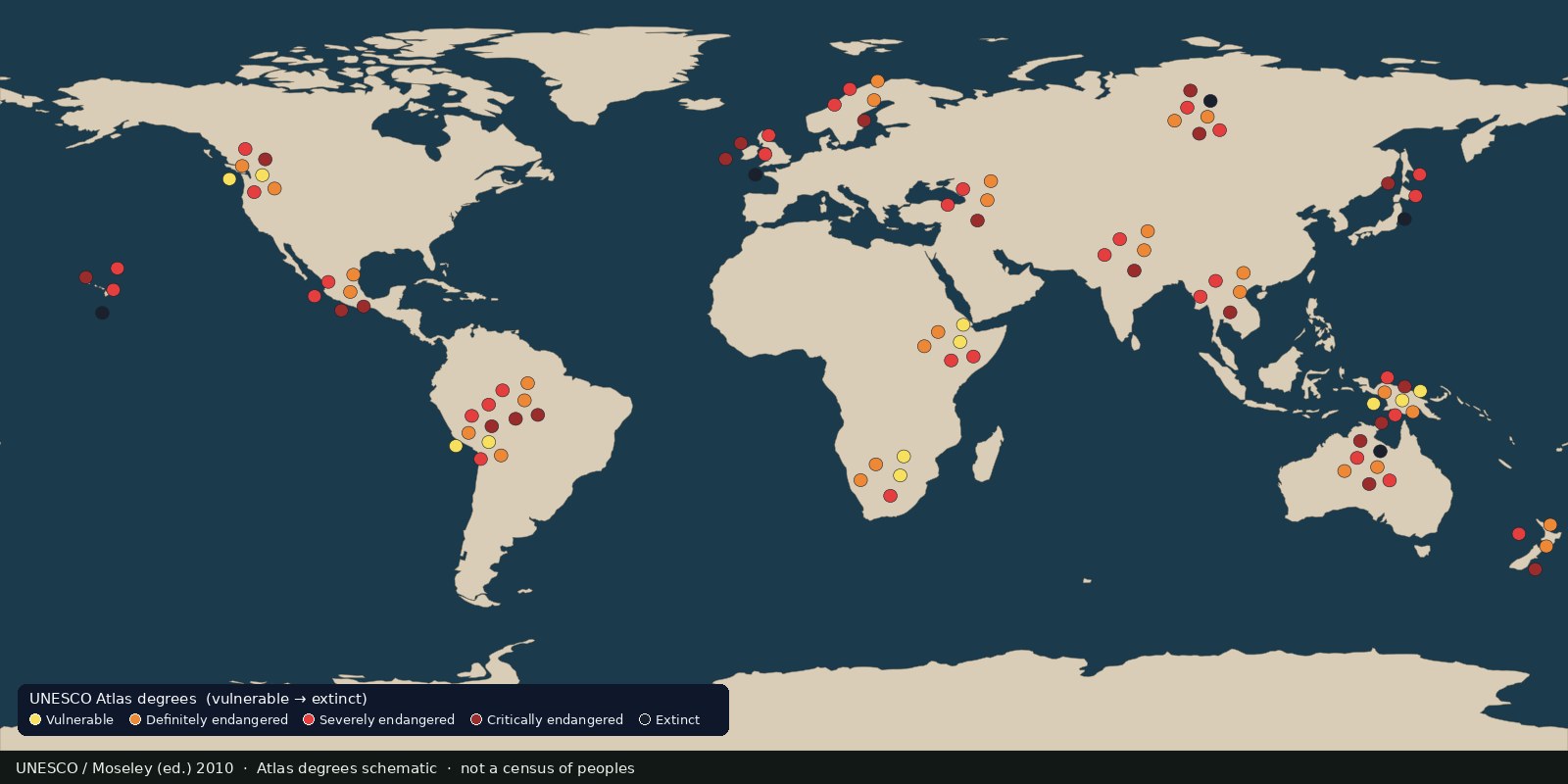 Fix Planet overview
Languages UNESCO listed as vulnerable to extinct, an endangerment atlas, not a census of peoples and not a second family-tree map.
Read the card →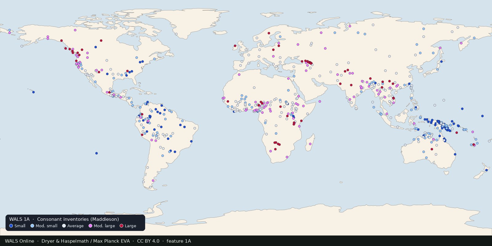
Structural features of languages: sound systems, word order, grammar, mapped from reference grammars. Typology, not ethnicity and not a family tree.
Read the card →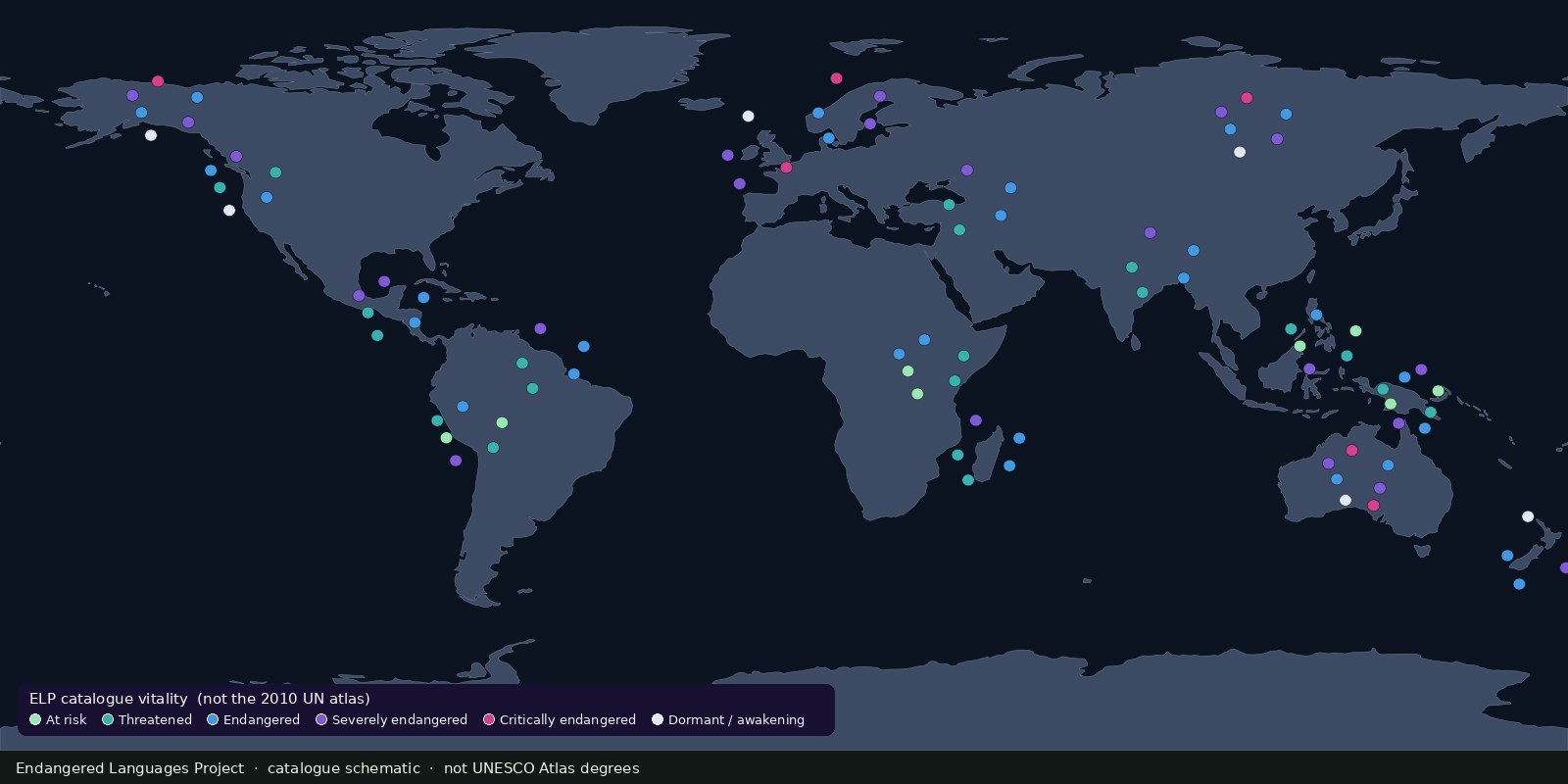 Fix Planet overview
A living catalogue and map of endangered and Indigenous languages with community resources, another endangerment lens beside UNESCO’s 2010 Atlas, not a second Glottolog.
Read the card →