

Ethnolinguistic
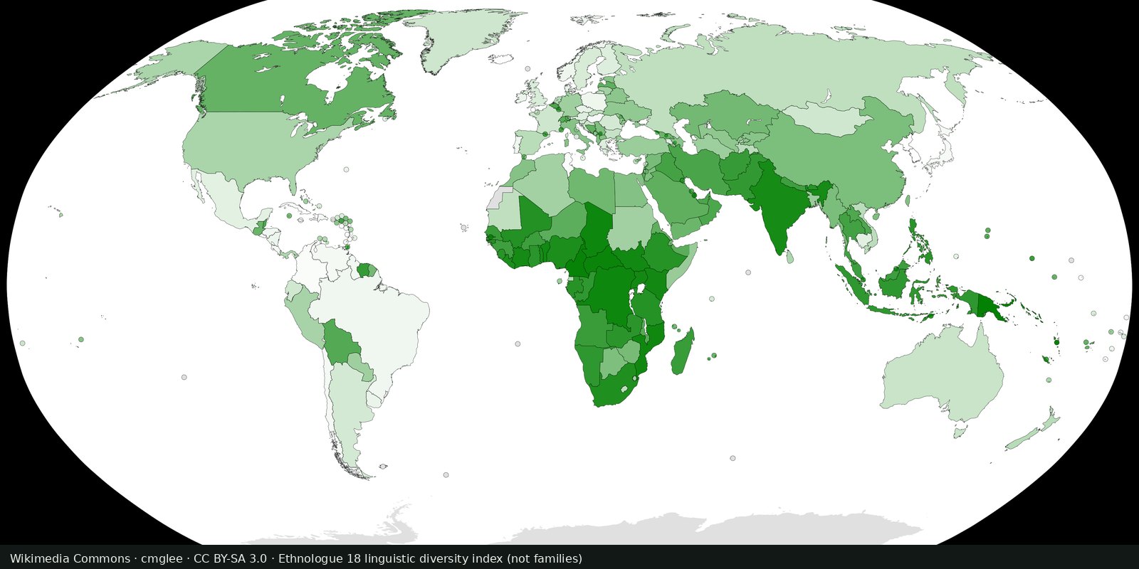
Living languages count
Ethnologue’s public insight on how many living languages are counted, a magnitude card next to the Glottolog family map, not a second family atlas.
Read the card →A linguistic map of related languages, an approximation of ethnolinguistic geography, not a census of peoples.
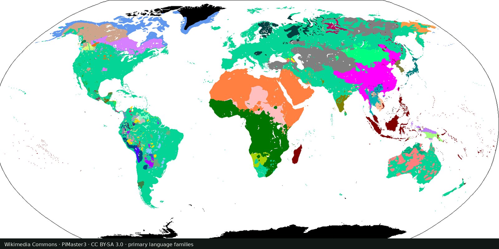
Glottolog, from the Max Planck Institute for Evolutionary Anthropology, classifies the world’s languages and shows them on a map. WALS (the World Atlas of Language Structures) is a related scholarly atlas of structural features. Both are about languages, not political ethnicity.
Glottolog (Max Planck Institute for Evolutionary Anthropology)
Vintage: 2024
https://glottolog.org/
Glottolog content is typically CC BY. The preview is Wikimedia’s Primary Human Language Families Map (PiMaster3, CC BY-SA 3.0). The interactive Glottolog map is theirs.
Colors and points stand for language families or languages, usually at a reference location. A large area of one color does not mean one “ethnic group,” one opinion, or one state. Many people are multilingual; many identities are not linguistic.
Ethnolinguistic maps are contested. Colonial borders, forced assimilation, and self-identification all cut across language trees. Treat this as a scholarly sketch of speech communities, never as a claim about blood, loyalty, or territory.
Open source map → Ethnologue’s public insight on how many living languages are counted, a magnitude card next to the Glottolog family map, not a second family atlas.
Read the card →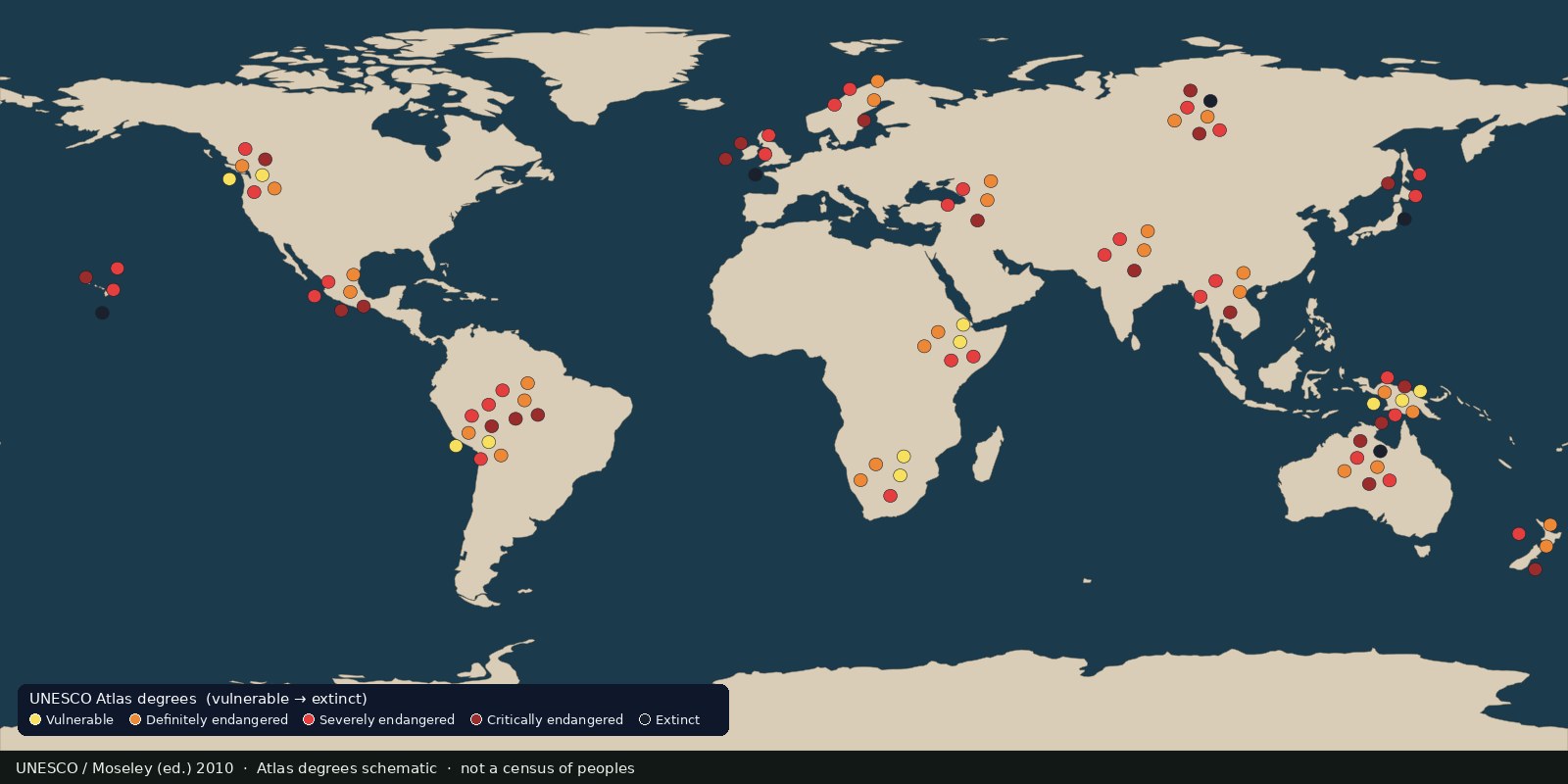 Fix Planet overview
Languages UNESCO listed as vulnerable to extinct, an endangerment atlas, not a census of peoples and not a second family-tree map.
Read the card →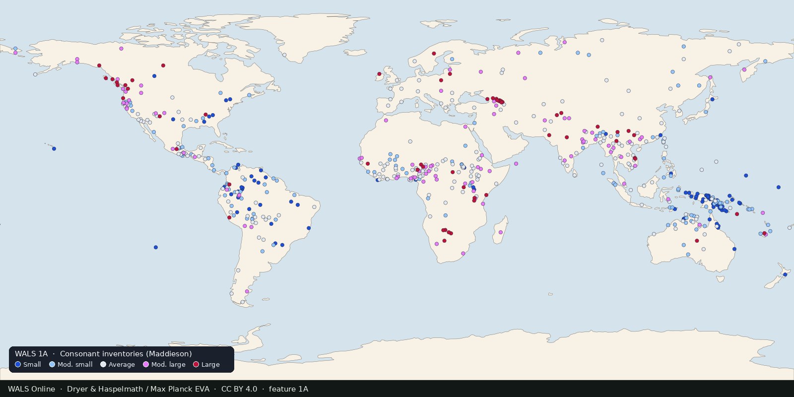
Structural features of languages: sound systems, word order, grammar, mapped from reference grammars. Typology, not ethnicity and not a family tree.
Read the card →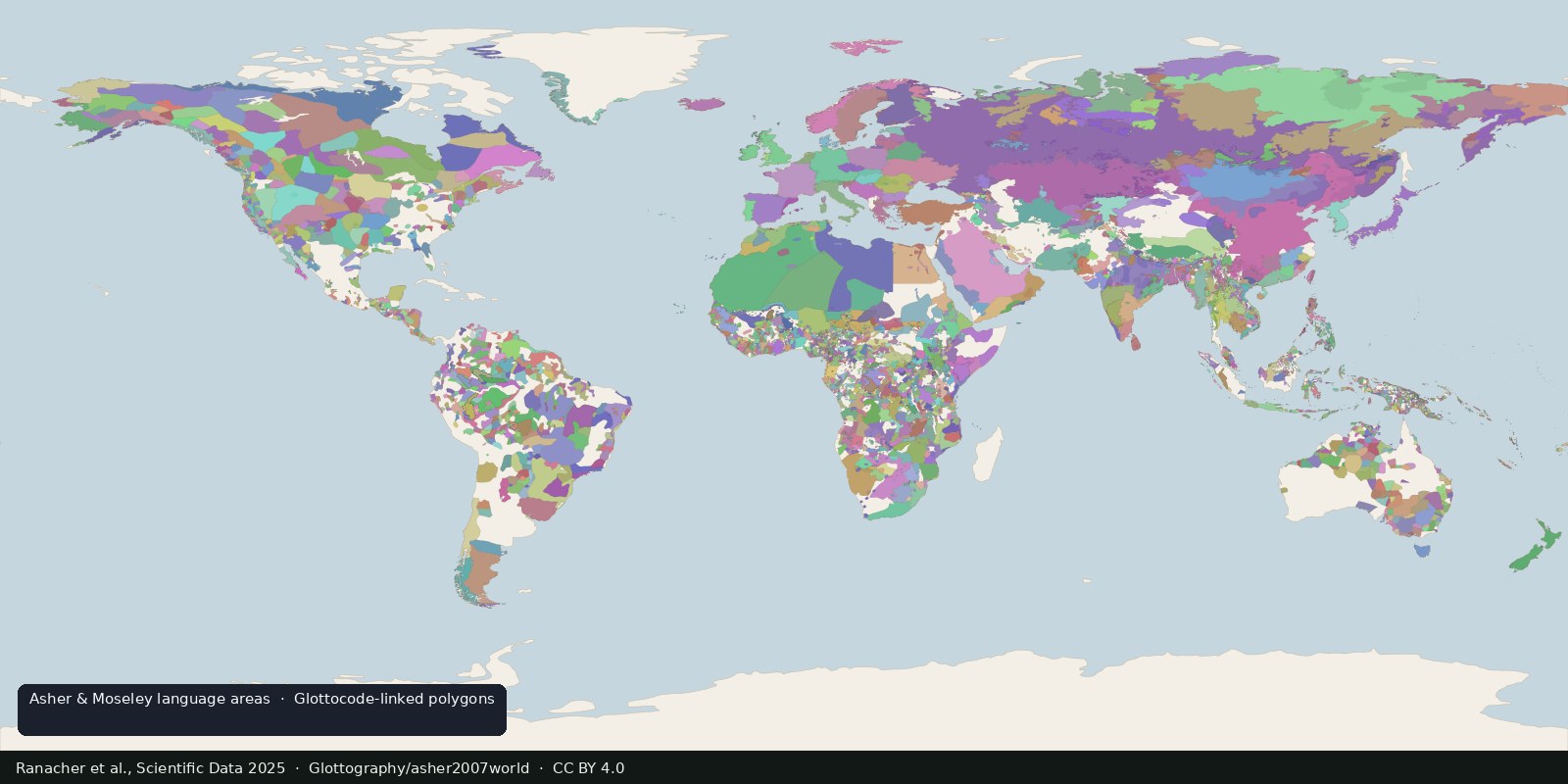
Open polygons for language areas digitized from Asher & Moseley’s atlas and linked to Glottocodes, areas, not single Glottolog points, and still not a census of peoples.
Read the card →Source: Ranacher et al., Scientific Data 2025: language areas from Asher & Moseley
 Fix Planet overview
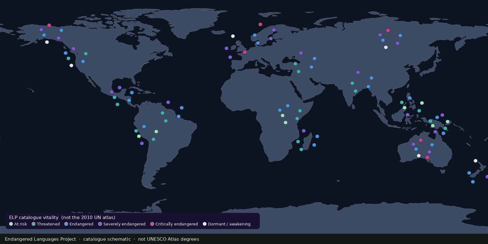
A living catalogue and map of endangered and Indigenous languages with community resources, another endangerment lens beside UNESCO’s 2010 Atlas, not a second Glottolog.
Read the card →