

Climate
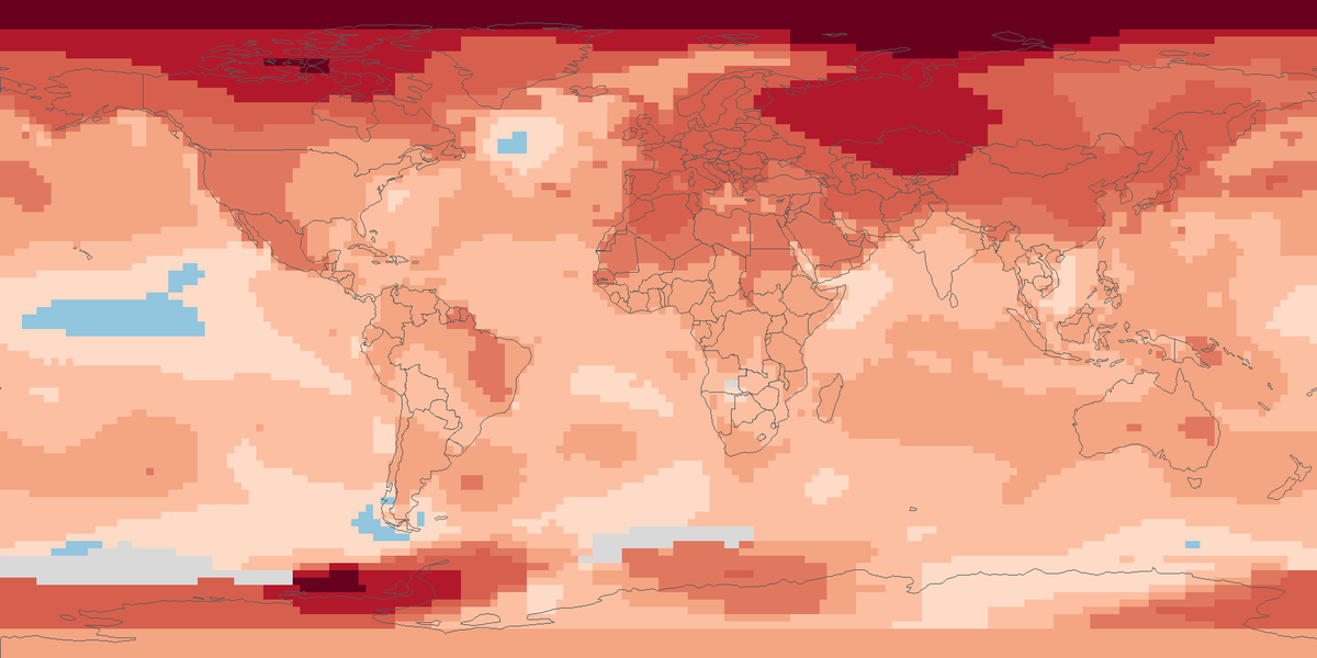
Surface temperature anomalies
Surface temperature across the globe in 2025, shown as the difference from the 1951 to 1980 average.
Read the cardShare of days with snow on the ground across the world's land in March 2026, seen by a satellite instrument.
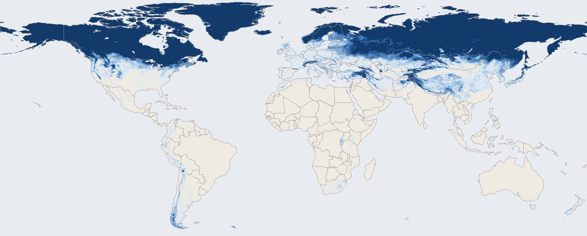
Shading shows the average snow cover during March 2026, in percent of days with a clear view.
Average snow cover on land in March 2026 on a 0.05 degree grid, from the Terra satellite. Antarctica is left off the map.
Map: Fix Planet, from the monthly snow cover product of the Terra satellite (Moderate Resolution Imaging Spectroradiometer) of the National Snow and Ice Data Center, March 2026. Data provided from a National Aeronautics and Space Administration led mission are licensed as Creative Commons Zero (CC0) (https://creativecommons.org/publicdomain/zero/1.0/). Citation is required: Hall, D. K. and Riggs, G. A. (2021) (https://doi.org/10.5067/MODIS/MOD10CM.061). Boundaries: Natural Earth, public domain.
The National Snow and Ice Data Center in the United States distributes a monthly snow cover product from the Moderate Resolution Imaging Spectroradiometer, an instrument on the Terra satellite of the National Aeronautics and Space Administration. It gives the monthly mean snow cover in cells of 0.05 degrees, about 5 kilometres, on a global grid, and it is derived from the daily product. Monthly values run from 1 March 2000 to the present.
Snow cover changes with the seasons and from year to year. Because the record begins in March 2000, the same month can be compared across more than twenty-five years with one instrument and one method.
Each cell shows the average percentage of snow cover during the month, taken over days when the satellite had a clear view. Darker blue means snow covered the ground on more days, from under 10 percent in the palest blue to 90 percent or more in the darkest. The warm sand colour on land means under 0.5 percent snow, or no usable observation. Ocean is light grey-blue. Antarctica is outside the map.
Cloud and darkness hide the ground from the satellite. Days without a clear view are left out of the monthly mean, and in the polar night there is no observation, so the far north is partly blank in winter. The product sets very low averages to zero. Its accuracy for snow is 88 to 93 percent in published studies, and spurious snow has been seen in places without snow. The product maps Antarctica as fully snow covered for visual reasons, which is why the continent is left off. A free Earthdata Login account is needed to download the original files.
Map: Fix Planet, from the monthly snow cover product of the Terra satellite (Moderate Resolution Imaging Spectroradiometer) of the National Snow and Ice Data Center, March 2026. Data provided from a National Aeronautics and Space Administration led mission are licensed as Creative Commons Zero (CC0) (https://creativecommons.org/publicdomain/zero/1.0/). Citation is required: Hall, D. K. and Riggs, G. A. (2021) (https://doi.org/10.5067/MODIS/MOD10CM.061). Boundaries: Natural Earth, public domain.
Open source map → Surface temperature across the globe in 2025, shown as the difference from the 1951 to 1980 average.
Read the card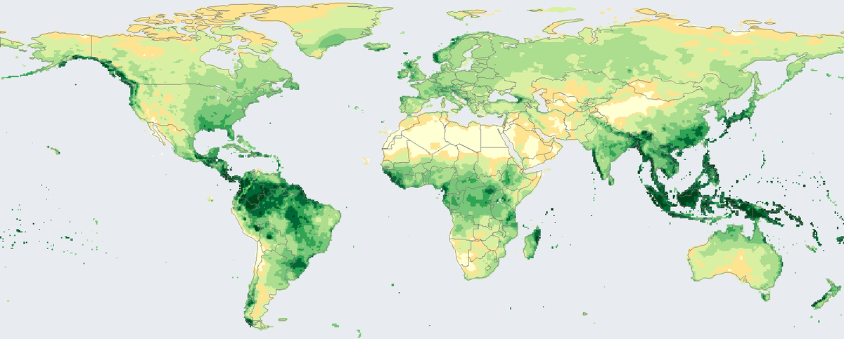
Total rain and snow that fell on land in 2024, in millimetres, from rain-gauge stations on a 0.5 degree grid.
Read the card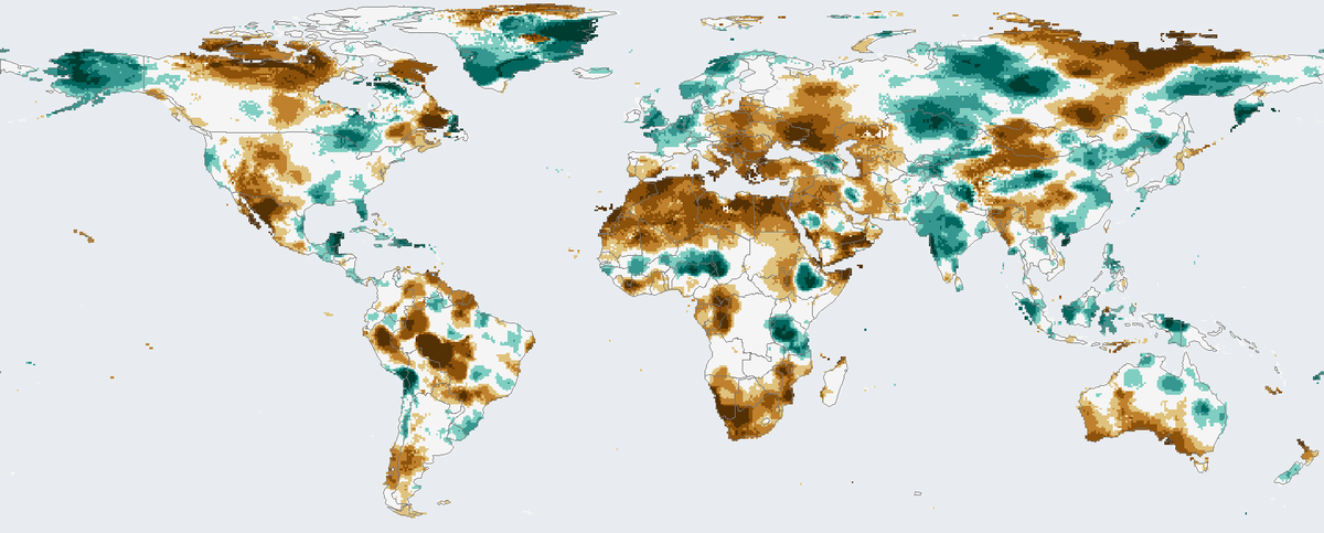
How much drier or wetter than usual the twelve months to December 2024 were on land, counting rainfall and evaporation.
Read the card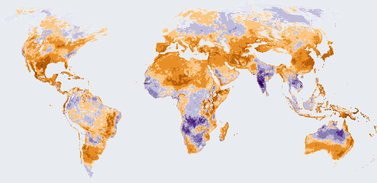
How many more or fewer days than usual brought strong heat stress outdoors in 2025, on land worldwide except Antarctica.
Read the card