

Population
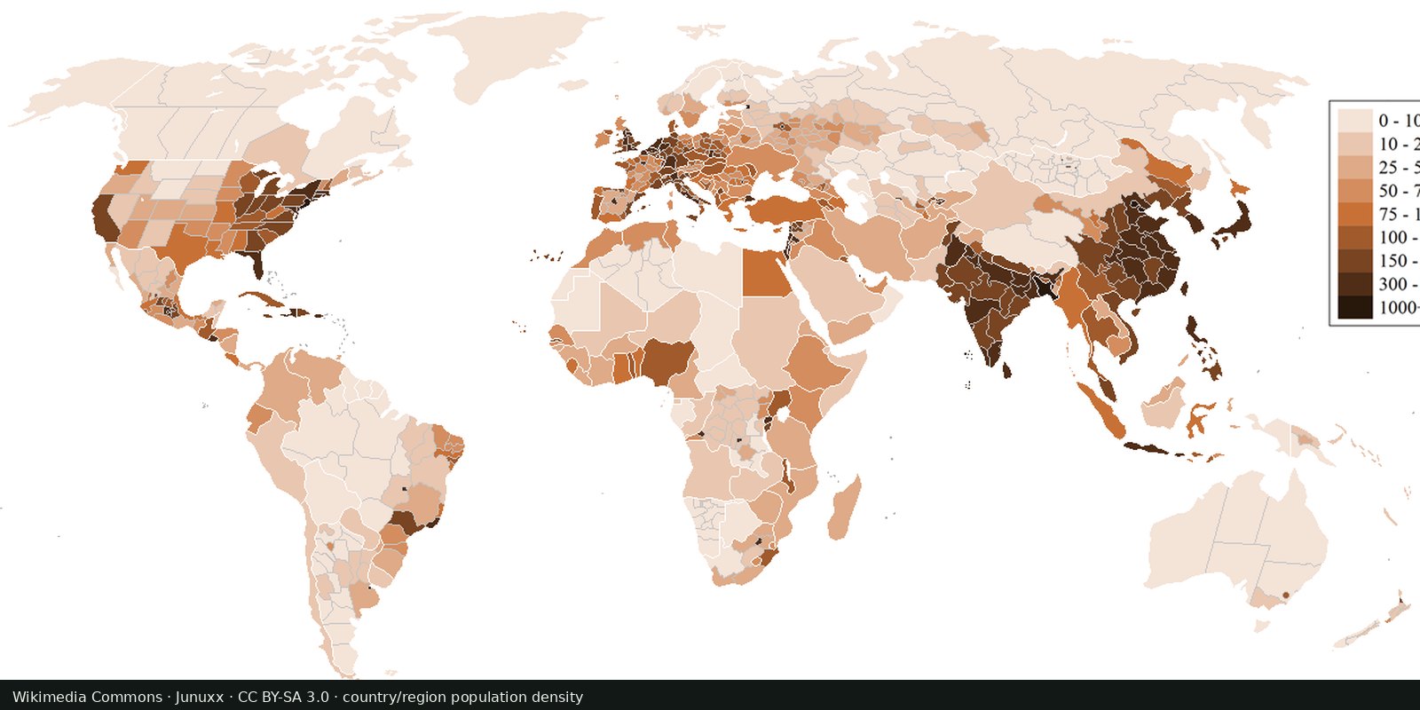
Population density
Where people live, gridded: NASA SEDAC GPW and WorldPop, models fitted to censuses, not a headcount of every street.
Read the card →NASA Black Marble: city lights and gas flares as seen from orbit, a picture of electrified settlement.
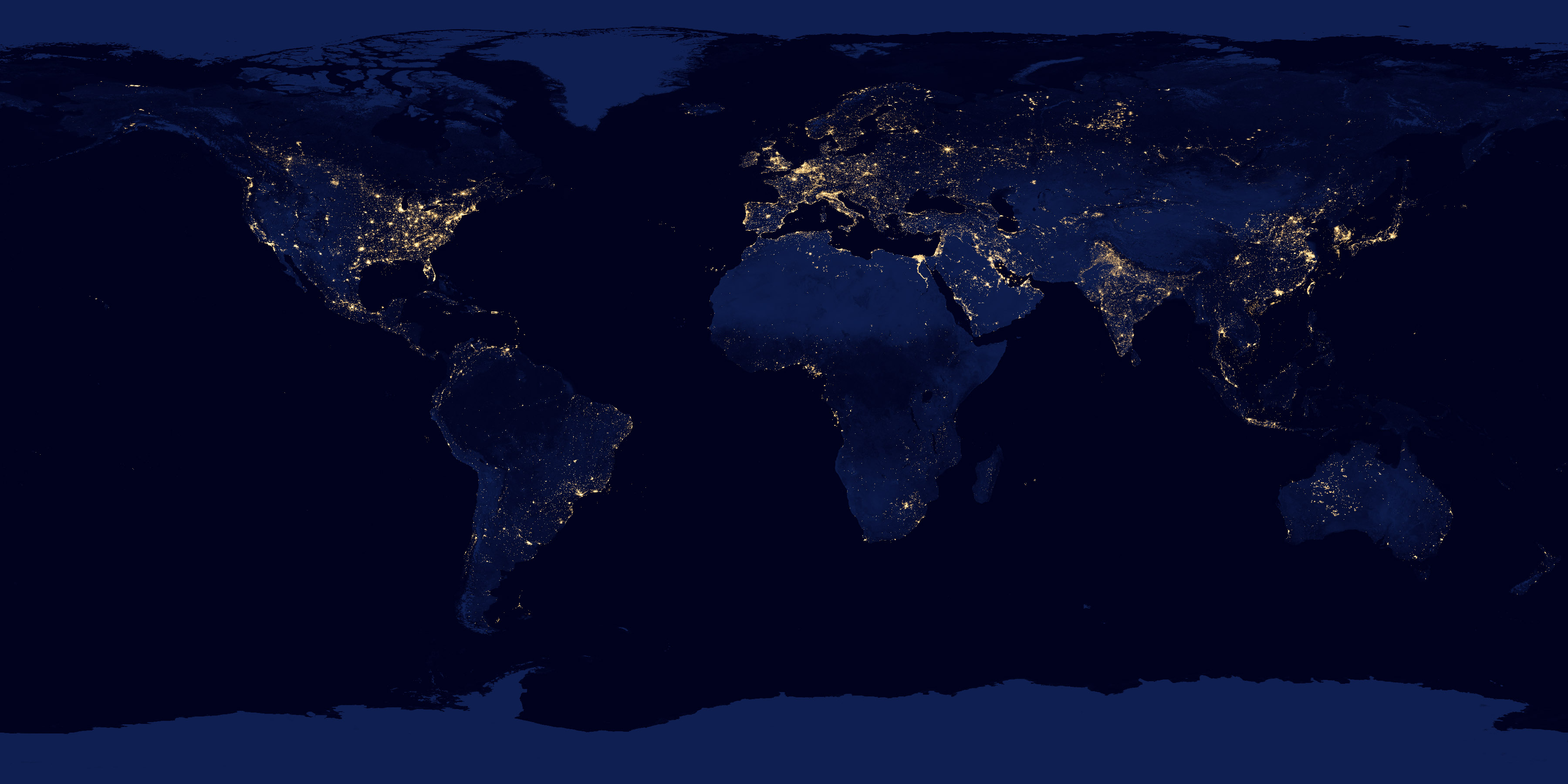
The 2012 VIIRS “night lights” flat map composites cloud-free observations from Suomi NPP. Later Black Marble products refine that view. Lights mark cities, roads, and some industrial flares; dark land can still hold many people.
NASA Earth Observatory / Suomi NPP VIIRS
Vintage: 2012
https://visibleearth.nasa.gov/images/79765/night-lights-2012-flat-map
NASA Earth Observatory imagery is public domain. We host the 2012 flat-map JPEG. Later annual Black Marble products are on NASA Visible Earth.
White is upward light. Oceans stay black. Compare with the population-density card: brightness follows electricity and wealth as much as headcount. Rural Africa and parts of South Asia are darker than their populations.
LED streetlights, moonlight algorithms, and gas flares all change the picture. A dark pixel is not “empty.” This 2012 mosaic is a vintage, not tonight’s Earth.
Open source map → Where people live, gridded: NASA SEDAC GPW and WorldPop, models fitted to censuses, not a headcount of every street.
Read the card →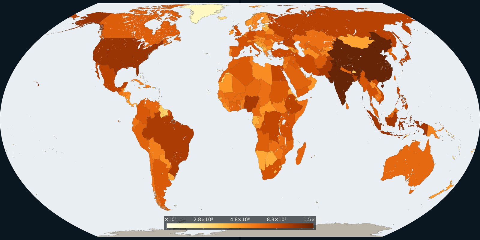
How many people live in each country on 1 July 2024, from the UN medium-variant estimates.
Read the card →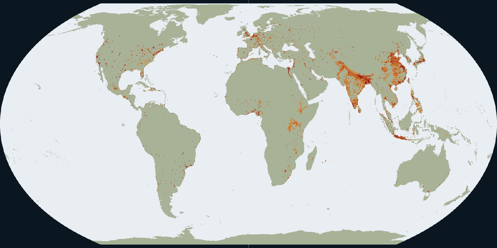
Urban centres, towns and rural land in the GHSL settlement grid for 2020.
Read the card →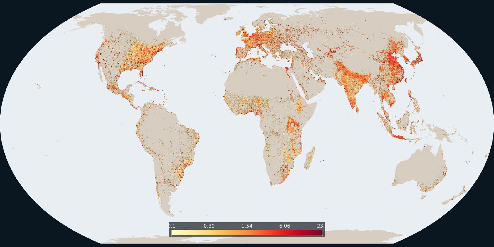
How much of each cell is built-up surface in the 2020 GHSL grid.
Read the card →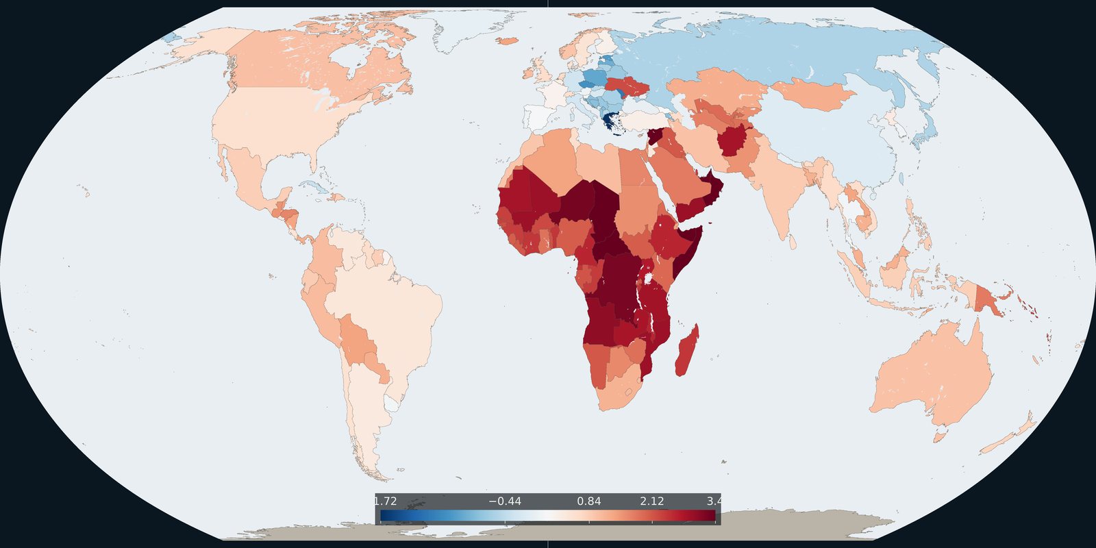
The 2024 annual rate of population change in each country, from the same UN medium variant.
Read the card →